Kuzeyoku
@kuzeyokumapsGeomorphologist, Geospatial analysis & Data visualisation
Similar User

@MerginMaps

@TheGISDiva

@EcoAutrement

@yunjinzh

@StadiaMaps

@spara

@Ninon_Blond

@AT_rouen

@ad_zerty

@Sutton_Map_Yoda

@XenonGT

@DWaltersdorfer

@ophe_pin

@OlivierM2019

@IsahAbdullaahi
#30DayMapChallenge 2024 Day 12: Time and Space An animation of storm induced flooding in Copenhagen from a scenario modeling potential conditions from a 1,000 year storm coming from the south in 2075. Made with #QGIS and #ffmpeg
My Blender conference talk is up: How to Improve Blenders UI: youtu.be/FJRO5wFTEc8?si… Why users struggle and a few ideas to improve it. The weakness of viewport feedback, shortcuts and status flags. #BCON24


We're looking at data from chess games this week for #TidyTuesday. Player rating seems to matter more if you play second! 📊 Slope chart made with {ggplot2} 🎻 Half-violin plots made with {gghalves} ✍️ Text formatting with {ggtext} #RStats #DataViz #ggplot2

This week, I'm diving into some fascinating vintage world maps🗺️ Adding modern topography to these historical beauties is always an exciting challenge for me. I'll be sharing more behind-the-scenes glimpses as I go—stay tuned! #arcgis #30daymapchallenge #MapArt #WeeklyUpdate
Germany Soil Map - Vintage Map Print etsy.me/3lMnGIH #artdeco #germanymap #shadedrelief #germanyoldmaps #germanymapposter #germanywalldecor

Texas Shaded Relief Map 02 - Map print etsy.com/listing/121492… #shadedreliefmap #texasmap #texas3dmapprint #texasvintagemap #texaselevationmap #texaswallmap #walldeco #wallmapprint

Italy - Vintage Map - Shaded Relief Map - Map Print etsy.com/listing/119060… #shadedreliefmap #italymap #italy3dmapprint #italyvintagemap #italyelevationmap #italywallmap #walldeco #wallmapprint

Political Map of the World 2015 - The World Wall Map - Map Print etsy.com/listing/122174… #shadedreliefmap #worldmap #world3dmapprint #worldelevationmap #worldwallmap #walldeco #wallmapprint

Iceland Geological Map - Vintage Map Print - Shaded Relief Map #shadedreliefmap etsy.com/listing/119287… #icelandmap #iceland3dmapprint #icelandvintagemap #icelandwallmap #walldeco #wallmapprint

Utah Shaded Relief Map #utahpostermap #utahvintagemapart #utahwallmap #utahwalldecor #utah3dmapprint #utahmap

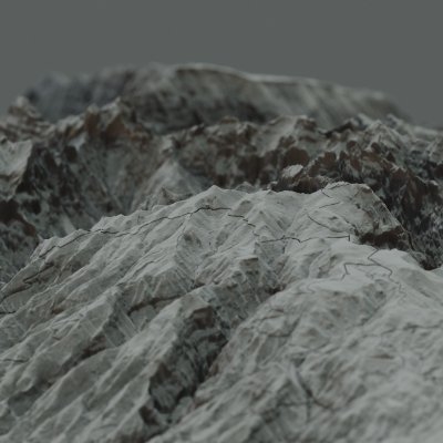
Spain soil map from 1966, digitally rendered and processed based on modern elevation data, reflects impressive landforms and amazing highlights/shadows #shadedreliefmap #spainmap #spain3dmapprint #spainvintagemap #spainelevationmap #spainwallmap #walldeco #wallmapprint

New Jersey - Geological Map - Shaded Relief Map - Map Print etsy.me/35Hmm5e #printingprintmaking #unframed #entryway #artdeco #map #shadedrelief #elevationmap #vintagemap #europe

Philippines Map - Shaded Relief Map - Art print etsy.me/3J2ZXx2 #artdeco #vintagemap #elevationmap #shadedrelief #3dmap #walldecor

Relief map of Turkey was created by Richard Kiepert in 1916 (Karte von Kleinasien). Richard Kiepert tarafından 1916 yılında oluşturulan Türkiye Rölyef Haritası'nı günümüz yükseklik verileri ve gerçek gün ışıklarıyla buluşturduk🔥 #vintagemapprint #map #shadedrelief

United States Trends
- 1. #PaulTyson 145 B posts
- 2. #SmackDown 43,9 B posts
- 3. Barrios 27,7 B posts
- 4. Rosie Perez 3.190 posts
- 5. Goyat 18,3 B posts
- 6. #NetflixFight 1.841 posts
- 7. Evander Holyfield 2.644 posts
- 8. #netfilx 1.405 posts
- 9. #NetflixBoxing 1.079 posts
- 10. Shinsuke 3.208 posts
- 11. Bronson Reed 3.435 posts
- 12. Cedric 7.058 posts
- 13. Purdue 6.964 posts
- 14. Lennox Lewis 1.309 posts
- 15. Bayley 5.875 posts
- 16. Seth 22,3 B posts
- 17. My Netflix 10,9 B posts
- 18. Grok 49,7 B posts
- 19. Cam Thomas 2.727 posts
- 20. Jared McCain 4.848 posts
Who to follow
-
 Mergin Maps
@MerginMaps -
 I'm still with Her. Find me @justjami.bsky.social
@TheGISDiva -
 L’Écologie Autrement!
@EcoAutrement -
 yunjinzh
@yunjinzh -
 Stadia Maps
@StadiaMaps -
 spara
spara
@spara -
 Ninon Blond
@Ninon_Blond -
 Les Amis de la Terre Rouen
@AT_rouen -
 Adriano Zerty
@ad_zerty -
 𝘾𝙝𝙧𝙞𝙨 𝙎𝙪𝙩𝙩𝙤𝙣 - 𝙈𝙖𝙥 𝙔𝙤𝙙𝙖
@Sutton_Map_Yoda -
 Sandon
@XenonGT -
 Daniela Waltersdorfer J
@DWaltersdorfer -
 Ophélia Pinto
@ophe_pin -
 Dr. Olivier Marchand
@OlivierM2019 -
 Isah Abdullahi 🌍
@IsahAbdullaahi
Something went wrong.
Something went wrong.


