ZHA0XU SUI
@SuiZhaoxuPhD Student, Cartographer🗺️, iGeo2018 10th Place🥇, UMN 2021'→U Oregon 2024’ → Penn State
Similar User

@AaronKoelker

@EduardShading

@SouthArrowMaps

@StaridasGeo

@AntonThomasMaps

@MindsBehindMaps

@mapbliss

@Cchurchili

@MapHustle

@g_fiske

@GeoWithJustin

@juliamakesmaps

@TimPrestby

@JoannaMerson

@oana_candit
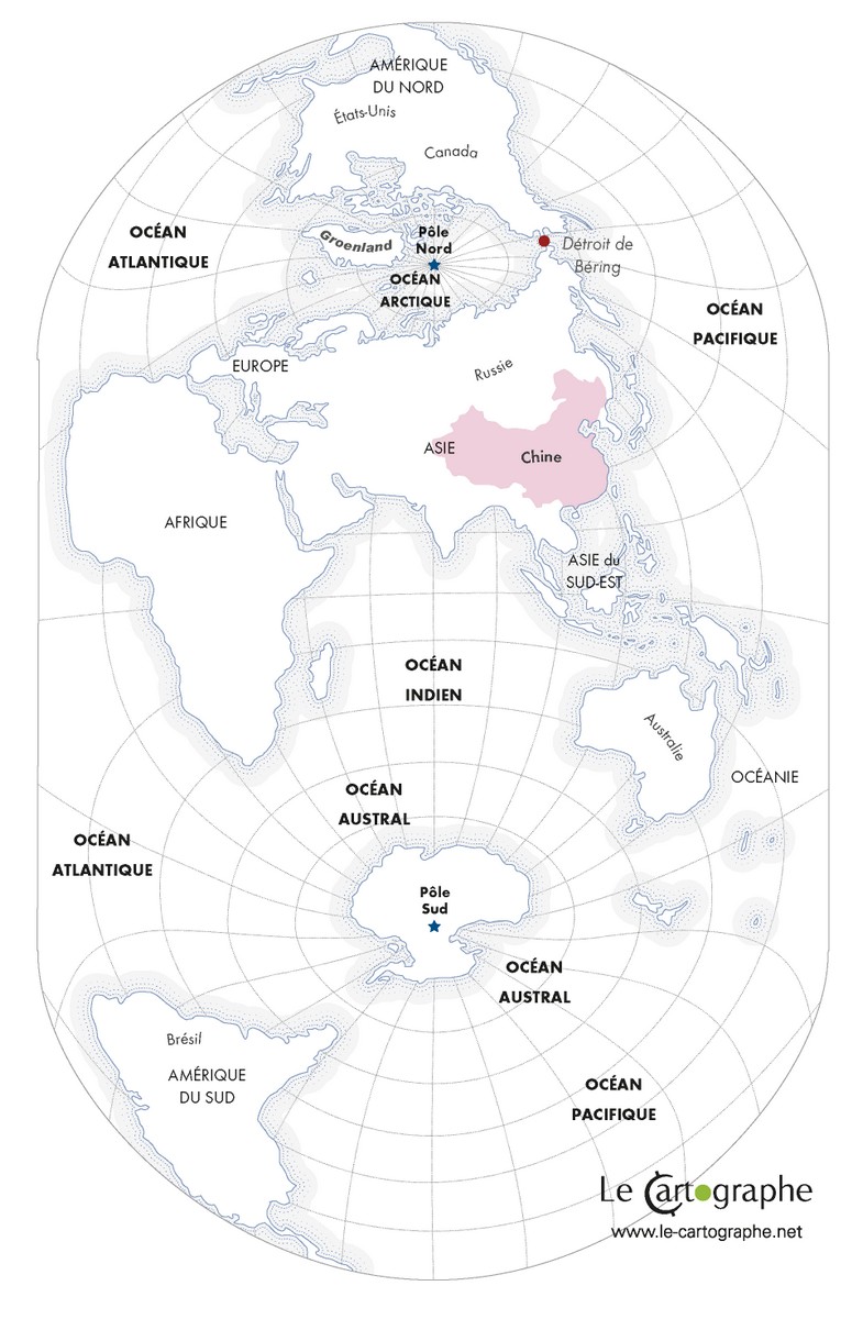
Voici la projection que les Chinois ont adoptée depuis quelques années. Centrée sur l'Himalaya, la Chine à mi chemin entre les deux pôles. La Chine centre du monde, pays du 3ème pôle. Les États-Unis loin de ce centre. Une carte de Hao Xiaoguang. A lire : geoconfluences.ens-lyon.fr/informations-s…
Great to see @TimPrestby @psugeography presenting the results of his dissertation work to create a new method for evaluating trust in maps @NACIS #NACIS2024

How do data journalists design mobile thematic maps? @lilyhoutman presents results from their MS research @psugeography at @NACIS #NACIS2024

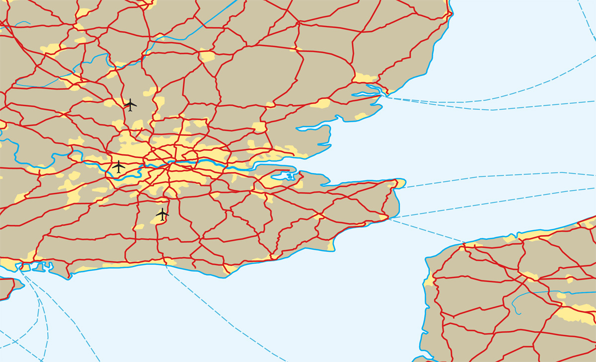
This morning @nacis we are announcing additions to the Natural Earth 6 dataset, including roads, ferry routes, and airports. A big thanks to @SuiZhaoxu for working on it. Get the beta data here: shadedrelief.com/ne-draft/
I presented a process of making a 3D relief globe at @NACIS . Feel free to check the tutorials at zhaoxusui.github.io/NACIS2024.pdf #nacis2024
So proud of GeoGraphics Lab students representing @psugeography today at @NACIS PCD! Lily, Zhaoxu, and Michael all contributing to the program. @lilyhoutman @SuiZhaoxu @mjc0203 #nacis2024

#HurricaneHelene is a tragedy. After making a bilingual news map to show its path and precipitation, I felt driven to contribute more, so I made another map to help identifying areas with power outage by comparing satellite images. Hope this effort counts. cartoguophy.com/maps/hurricane…


volcanes argentinos - argentine volcanoes code github.com/thomasartopoul…

Fun little transit style roadmap of the road

I'm greatly looking forward to the NACIS conference in Tacoma. Have started preparing for my presentations—one solo, and as the sidekick in two others. nacis2024.sched.com


Congratulations Kelby!
Mapping this amazing region is something that I had to do—as a 3D perspective view, of course. If you enjoy looking for Easter eggs, the scene contains two boats and an airplane. Check it out here: shadedrelief.com/patagonia-lake…

NEW #map “Stamp Maps” of 27 cities in the Yangtze River Delta Region It has won🏆Honorable mention AND 🏆Popularity award in the 1st Yangtze River Delta creative map design competition. Designed for the Chinese market, it's in Chinese and Pinyin. 🧵Details in EN


I like making big blue maps of remote places. Here's my latest: shadedrelief.com/patagonia

I recently moved to PA after a 9-day cross-country trip. To memorate my past 5 years in USA, I made this map marking all places I've driven/been in US/CA/MX, with two lists of World Heritage Sites/National Parks I've been to.

Pre-orders for Volume 7 are available now! Read more on our blog at: atlasofdesign.org/2024/08/14/vol…
United States Trends
- 1. Serrano 165 B posts
- 2. #TysonPaul 78,4 B posts
- 3. #NetflixFight 41,2 B posts
- 4. #netflixcrash 5.262 posts
- 5. #buffering 6.903 posts
- 6. Ramos 64 B posts
- 7. ROBBED 71,4 B posts
- 8. Shaq 8.619 posts
- 9. My Netflix 49,8 B posts
- 10. Rosie Perez 8.376 posts
- 11. Cedric 14,4 B posts
- 12. Jerry Jones 6.961 posts
- 13. #boxing 34,1 B posts
- 14. WTF Netflix 12 B posts
- 15. Christmas Day 13,8 B posts
- 16. Love is Blind 4.365 posts
- 17. The Netflix 228 B posts
- 18. $NFLX 4.485 posts
- 19. Streameast 2.463 posts
- 20. Robbery 18,6 B posts
Who to follow
-
 Aaron Koelker
@AaronKoelker -
 Eduard
@EduardShading -
 Andrew Tyrrell
@SouthArrowMaps -
 Staridas Geography
@StaridasGeo -
 Anton Thomas
@AntonThomasMaps -
 Minds Behind Maps
@MindsBehindMaps -
 David M
@mapbliss -
 Carl Churchill
@Cchurchili -
 Emory Beck
@MapHustle -
 Greg Fiske
@g_fiske -
 Geography with Justin
@GeoWithJustin -
 Julia Olson
@juliamakesmaps -
 Tim Prestby
@TimPrestby -
 Joanna Merson
@JoannaMerson -
 Oana Candit
@oana_candit
Something went wrong.
Something went wrong.


