Brad Rousseau
@bradrousseauMeteorologist and storm chaser in Canada and USA.
Similar User

@westernuNTP

@daynavettese

@BraydonMoreSo

@dave_sills

@isabel_ONwx

@NTP_Reports

@vaughanweather

@NicoleKarkic

@IWeatherSK

@WxMelinda21

@georgekourounis

@stormwx1

@blizzardof96

@StormhunterTWN

@matt_grinter
Live streaming #HurricaneHelene from Perry FL. About 2 hours from landfall, inner rain bands hitting us now with stronger gusts. It will continue to go downhill from here youtube.com/live/zkqEia1t1…
This is some wild fire behaviour. Also, not sure if the colour is just an artifact of the camera or is those flames are legitimately purple.
TERRIFYING footage from a live cam in the path of the #BridgeFire in Southern California. On Mount High’s East Summit. Monster flames and even some quick firenado spin ups! #CAwx
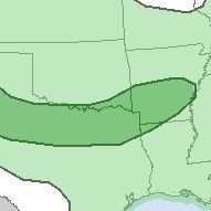
A reminder that these maps don't forecast storm probability but forecast the hazard potential/impacts. So the map here is forecasting the risk for storms with hazards of moderate impact across area A and hazards of minor impacts across area B.
Fun thread on rainfall in Toronto this year.
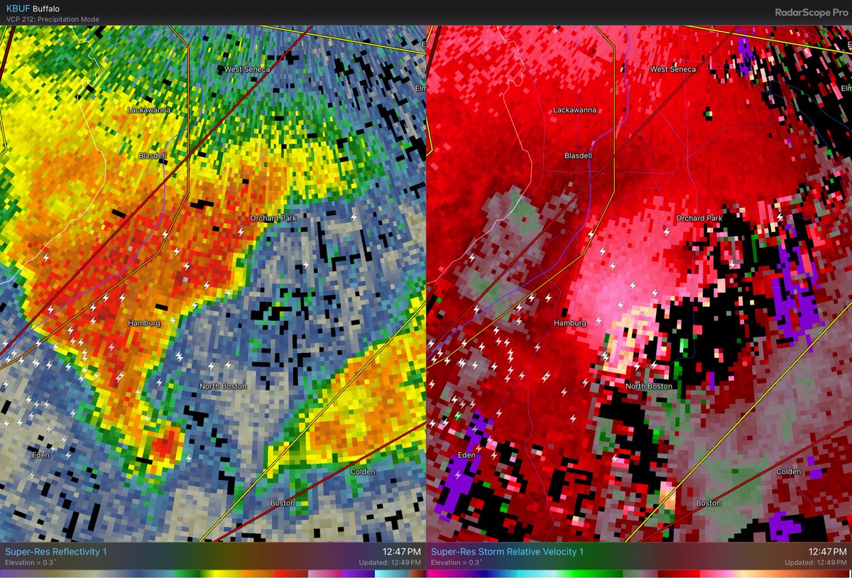
Orchard Park and @HighmarkStadm will have a close call with this potentially tornadic supercell. #nywx #BillsMafia
To the "experts" in the comments - this is not 'just a few summer days'.. you may be comfortable if you have A/C and work indoors.. but vulnerable populations like elderly & those who don't have A/C or work outdoors are at higher risk of heat-related illness this week in Ontario.
'Dangerously hot and humid conditions' to begin on Monday across much of southwestern Ontario, says Environment Canada cp24.com/news/dangerous…
Before the Olustee tornado, the supercell was a dust-eating monster. This 8 shot panorama captures the strong rotation, intense cloud shapes, and the dust getting pulled into the storm. 5/23/24. #okwx #wxtwitter @stormhour

Some more images of the #tornado that I intercepted near Bendavis, Missouri on May 26 2024. @NWSSpringfield #MOWX @weatherchannel @ReedTimmerUSA @USTornadoes


"Little swirls are observed to feed on bigger swirls, which feed on, or spin off, even larger ones." I can't recall the exact publication that came from but my synoptic 1 prof quoted it in lecture one day and for some reason it really stuck with me.
We've got a vortex rotating around a vortex rotating around another vortex This one goes at least three levels deep
An evacuation alert remains in effect for #FortMcMurray, Saprae Creek, Gregoire Lake Estates, Fort McMurray First Nation #468, Anzac, and Rickards Landing Industrial Park. People in those areas should be prepared to leave on short notice if risk from the #ABfire escalates. #ABwx

Update: Hundreds of residents in @RMWoodBuffalo have been ordered to leave their homes as a wildfire burning southwest of Fort McMurray continues to draw closer. Evacuation order is in effect for Beacon Hill, Abasand, Prairie Creek, and Grayling Terrace. #abfire #ABwx
Little excitement with the storms tracking across southwestern #ONstorm this evening. Note the observed sounding from Detroit shows no surface based instability. Meaning storms are elevated in nature and not really severe in nature.

I guess many don't realize (or choose to ignore) this fact. CAMs aren't useful at picking up the large scale "background" environment.
While many focus strictly on CAM's, I still find value in watching coarser models to see hints of synoptic scale ascent and moistening to trigger convective schemes. The NAMs consistent view of convection forming in central OK between 0-3z in a high end parameter space is…

🙌 🍁 🎉 Heading out to #MapleLeafsSquare this evening❓ 👇Below is your weather forecast for Downtown Toronto for the @MapleLeafs 🍁 vs @NHLBruins game tonight! 🕖 Puck drop is at 8 P.M. EDT. #ONwx #GoLeafsGo

A great example of "play north of the meso at the risk of your peril."
Textbook example of how supercells and their tornadoes can have wildly different motion vectors
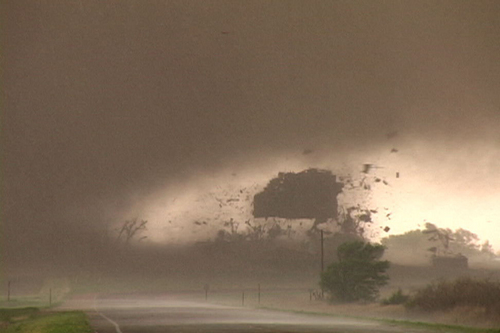
I believe this is what a trench digging supercell looks like.
Textbook example of how supercells and their tornadoes can have wildly different motion vectors
United States Trends
- 1. McDonald 50,6 B posts
- 2. #AskFFT N/A
- 3. Mike Johnson 53 B posts
- 4. #RollWithUs N/A
- 5. Good Sunday 70,5 B posts
- 6. #sundayvibes 8.347 posts
- 7. Go Bills 4.983 posts
- 8. Big Mac 4.930 posts
- 9. Coke 33,6 B posts
- 10. #AskZB N/A
- 11. Sunday Funday 5.008 posts
- 12. Tillman 1.856 posts
- 13. Happy Founders N/A
- 14. #ATEEZ_1stDAESANG 12,6 B posts
- 15. Jon Jones 301 B posts
- 16. NFL Sunday 5.560 posts
- 17. CONGRATULATIONS ATEEZ 22,4 B posts
- 18. Founders Day 1.133 posts
- 19. McDs N/A
- 20. Blessed Sunday 21 B posts
Who to follow
-
 Northern Tornadoes Project 🇨🇦
@westernuNTP -
 Dayna Vettese 🌪️
@daynavettese -
 Braydon Morisseau
@BraydonMoreSo -
 Dave Sills 🍁
@dave_sills -
 Isabel
@isabel_ONwx -
 NTP Reports
@NTP_Reports -
 Tom Stef
@vaughanweather -
 Nicole Karkic - Video Meteorologist
@NicoleKarkic -
 Instant Weather Saskatchewan ⚡️
@IWeatherSK -
 Melinda Singh TWN
@WxMelinda21 -
 George Kourounis
@georgekourounis -
 Stormwx1
@stormwx1 -
 Ethan Sacoransky
@blizzardof96 -
 Mark Robinson
@StormhunterTWN -
 Matt Grinter
@matt_grinter
Something went wrong.
Something went wrong.

