Valt Ze
@ValtzenGeographic exploration, abstract landscapes & aesthetic experiments using spatial data Daily @eumetsat USC Insta'nt cooker: valt_zen
Similar User

@Go__pika

@sergioajv1

@VITO_RS_

@Keiko_geo

@sinergise

@fortiain

@eoscenefrom

@flasmendes

@WomenCopernicus

@RemoteSens_MDPI

@eo_college

@annamaria_84

@gena_d

@SabrinaSzeto

@dmlmont
Dynamics of suspended sediment in the Irbe strait seen by #Sentinel2 on 01/03/22 Interaction with bathymetric features and local currents creates large scale vortices around cape #Kolka Explore & discuss the image @Soar_Earth ➡️bit.ly/CapeKolka #BalticSea #Latvia #Spring

Happy 26th birthday to GDAL ! From the first commit on 1998-10-17 from a small rural town outside of Ottawa Canada, to almost every geospatial software installation on the planet (and satellites and other planets!) in 26 years. The ultimate example of sharing & community. #foss4g

Here we go, folks! Sentinel-1C will restore the S1 mission to full capacity, a hotly anticipated launch! Good luck to all the team working on this…a busy few weeks ahead.
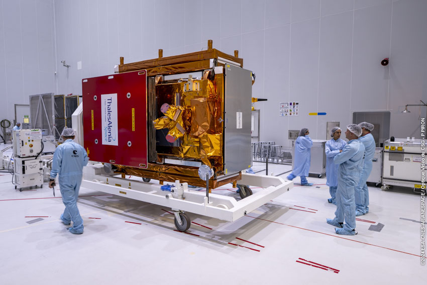
The @CopernicusEU #Sentinel1 C satellite is now out of the shipping container that kept it safe while travelling to the launch site in French Guiana. The satellite is set to liftoff on 3 December🚀 📸Credits: ESA-CNES-ARIANESPACE/Optique vidéo du CSG–S. Martin

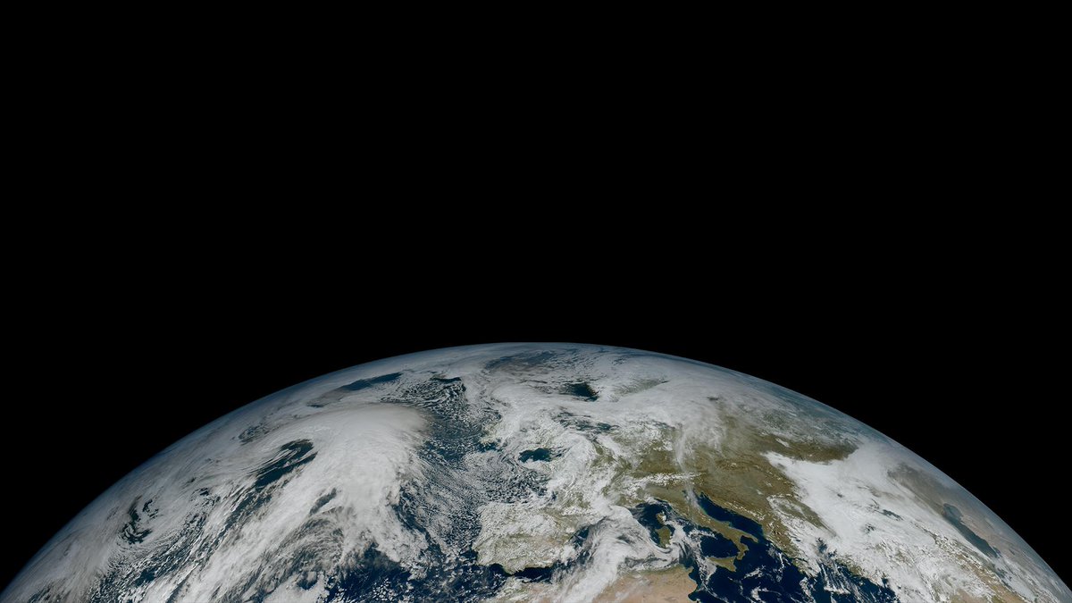
Good news! 🥳 From today, pre-operational data from the FCI instrument on board #MTGI1 will be available to weather forecasters around Europe & beyond! 🛰️ The FCI produces more frequent, higher-resolution images than previous-generations. Find out more 👉bit.ly/3zipXWs
🛰🧠🪢
New post! I’ve long felt that finding and using satellite data was harder than it should be. Why? And how can we make it easier? My thoughts: medium.com/@robsimmon/mak…
Stunning first image from the @CopernicusEU #Sentinel2 C satellite! This is just one of the initial images that arrived: they stand as a powerful testament to the success of this extraordinary mission👏👏 Explore the full set: esa.int/Applications/O…\
Tonight, we launch our latest satellite, #Sentinel2C. 🛰️ This sat allows us to continue the fantastic Sentinel2 mission: Providing high resolution, very accurate, freely available imagery for the whole globe. This is one of my favourite Sentinel2 images. What's yours? 😀

#EMSR742 #Latvia 🇱🇻 Last night, our #MappingTeam delivered its Delineation Product for the storm which affected the surrounding areas of #Riga ➡️As of 30 July, at 08:17 UTC, a total of 140 ha of flooded area has been detected 🌊 More details at👇 rapidmapping.emergency.copernicus.eu/EMSR742/report…

Tracking some ocean eddies with SAM 2. :) Data from #FESOM2 1-km simulation of the Arctic Ocean.
⚡️⚡️⚡️
📢Meteosat Third Generation (#MTG) Lightning Imager (LI) level 2 data will be available to all users on EUMETCast and via the Data Store today bit.ly/3RTT1ta

It's our birthday! 🥳 #OTD in 1986 @eumetsat was formed in order to service the needs of its 30 member states for timely & accurate weather & #climate data. We now operate a system of satellites observing the planet 24/7 🛰️ Find out more about us here: eumetsat.int
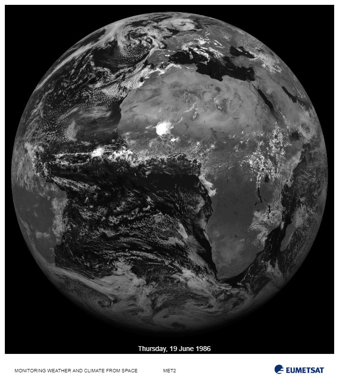
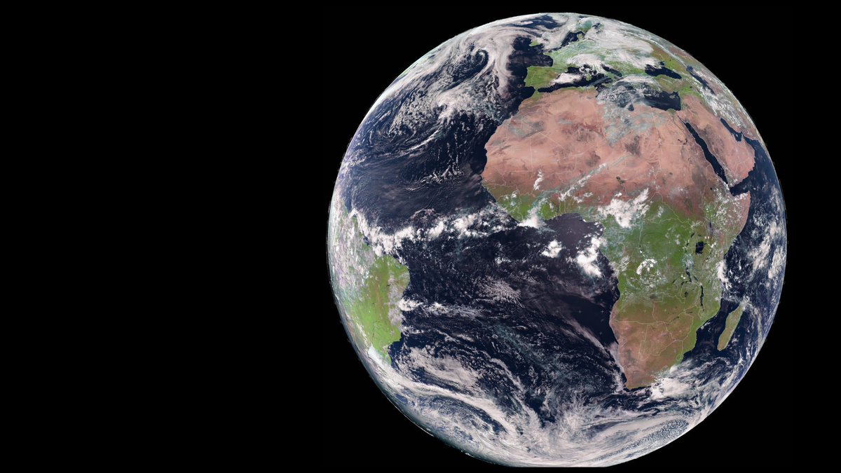
My, oh my. Just take a few seconds to take it in. 🌍✨ This week’s image shows the Earth as seen from the vantage point of the 🛰️ Meteosat-11 geostationary weather satellite, 36,000km above our planet. Shout out to @EUMETSAT for another amazing shot! 📸👏
🎨🖌️The mystery of #MonaLisa 's location solved! The first public map and 3D view! On @Soar_Earth: See here: soar.earth/draw/941

🎨 AMAZING! The mystery of #MonaLisa's location has now been solved thanks to topography/mapping technology. However, thanks to @Soar_Earth you now have the worlds first public map and 3D view of the location of the landscape in the most famous picture in the world! See…

Generative landscape, Bolivia 🇧🇴🌱🛰️ Geometric layout of agriculture plots as a result of large scale land development in the previously forested area 🔎&💬the #Sentinel1 mosaic on @Soar_Earth atlas: bit.ly/SantaCruz_BO #MapMonday #generativeart #earthart #Bolivia

This splendid image by Hubble, released on 9 September 2003, shows Saturn's Southern Hemisphere and the southern face of its rings as seen in ultraviolet light. Ultraviolet light, which has short wavelengths and high energy, can't be detected by our eyes, but Hubble can capture…

The Elbe River estuary 🇩🇪 is an important habitat to many endangered species, including fish 🐟, birds 🐦, and even seals 🦭 #Copernicus satellites help monitor valuable ecosystems like this one around the 🌍 ⬇️ #Sentinel2🇪🇺🛰️ image

High-Resolution Radar Satellite image of the #floods in #Brazil Kindly provided by @umbraspace to @Soar_Earth: ➡️soar.earth/maps/18656 It was cloudy, but radar can image through clouds, seeing islands and margins flooded We'll try to explain a bit here its interpretation: /🧵

Imagem de satélite da região metropolitana de #PortoAlegre Em @Soar_Earth: x.com/Soar_Earth/sta…
UPDATE! Super HQ satellite image showcasing the extent of the floods in Southern Brazil 🇧🇷 - May 6, 2024. To view and explore this image in HQ click here ➡️ soar.earth/maps/18665?pos… Source: Copernicus 🛰️ Sentinel-2/Copernicus Browser. #flood #floods #Brazil #disaster
We have a series of maps available of the flood in Rio Grande do Sul, Brazil: bit.ly/4a095Qj The maps use optical images and radar data from multiple satellites to estimate the extent and impact of the flood at different areas.


Extensive thunderstorms developed over large portion of Germany yesterday afternoon, due to a cold front moving from the southwest ⛈️ Below: The Lightning Imager (LI) revealed the rapid intensification of storms & tracked their evolution until they weakened in the late evening 🛰️
United States Trends
- 1. Tyson 528 B posts
- 2. Karoline 21 B posts
- 3. #wompwomp 6.925 posts
- 4. Syracuse 22,2 B posts
- 5. Paige 7.802 posts
- 6. Kiyan 26,6 B posts
- 7. Pence 61,7 B posts
- 8. Kash 107 B posts
- 9. The FBI 274 B posts
- 10. Debbie 35,8 B posts
- 11. Jarry N/A
- 12. Whoopi 117 B posts
- 13. #LetsBONK 16,6 B posts
- 14. Dora 24,7 B posts
- 15. #TOKKIVSWORLD 1.775 posts
- 16. Villanova 1.848 posts
- 17. White House Press Secretary 21,2 B posts
- 18. Ace Bailey N/A
- 19. Kyle Neptune N/A
- 20. Bucks County 98,2 B posts
Who to follow
-
 🛰️Dr. Gopika Suresh 📡🌏🖖🏽🇩🇪🇮🇳
@Go__pika -
 Sérgio OSMsmaprs
@sergioajv1 -
 VITO Remote Sensing
@VITO_RS_ -
 Keiko
Keiko
@Keiko_geo -
 Sinergise
@sinergise -
 Iain H Woodhouse 伊恩🛰🌍🌳🏴🌻
@fortiain -
 Scene From Above Podcast
@eoscenefrom -
 Flávia Mendes, @[email protected]
@flasmendes -
 Women in Copernicus
@WomenCopernicus -
 Remote Sensing MDPI
@RemoteSens_MDPI -
 EO College 🎓
@eo_college -
 Annamaria Luongo
@annamaria_84 -
 Gennadii Donchyts
@gena_d -
 Sabrina Szeto
@SabrinaSzeto -
 David Montero Loaiza
@dmlmont
Something went wrong.
Something went wrong.

