USGS Landsat
@USGSLandsatOfficial USGS account for the Landsat Program - a series of Earth-observing satellites co-managed by @USGS & @NASA. Imaging the Earth since 1972.📡🛰️
Similar User

@NASA_Landsat

@HumboldtEOLab

@RemoteSens_MDPI

@NASAEarthData

@ESA_EO

@CopernicusEU

@Geographyrealm

@USGS_EROS

@jstnbraaten

@sentinel_hub

@GEDI_Knights

@NASAEarth

@mikewulder

@giswqs

@CopernicusLand
A new Latest in Landsat is available! In October, Annual NLCD, the next generation of USGS #LandCover, was debuted. A new study was published that estimated the 2023 value of #Landsat at $25.6 billion. Read more highlights and the full issue here: ow.ly/W1Uo50U841r

We are proud to partner the @USGS on the #Landsat #satellite program. Together, we've brought the benefits of space down to Earth for the last fifty years. Thank you to @USGS and @USEmbAustralia Ambassador Caroline Kennedy as we embark on #LandsatNext and the next 50 years.


During the 25-year mission of #Landsat 7, it made 133,000 orbits, captured 3.3 million scenes, received more than 117,000 commands, and was maneuvered on 253 occasions. Learn more about its legacy by listening to the latest Eyes on Earth podcast episode: ow.ly/KNyt50U5FoP
#ManicouaganReservoir, which lies within the remnant of an ancient impact crater, was created after the construction of the Daniel-Johnson Dam in 1968. A declassified satellite image from 1964 reveals the pre-reservoir landscape. Learn more here: ow.ly/UR3T50U6jPF #Landsat
During its 41 years in operation, the Hobet Coal Mine in #WestVirginia drastically altered the geography of the region. #Landsat provides a cost-effective method for monitoring mine lands and measuring the success of #Reclamation efforts. Learn more here: ow.ly/vtqF50U6nib
🌊 Curious how #Landsat satellites help map the ocean floor? @USGS scientists developed a new method to measure shallow ocean depths using satellite data. Hear more from the experts in our Eyes on Earth Podcast 🎙️ usgs.gov/centers/eros/s…
It’s called Landsat, but these satellites study more than just land! @USGS scientists developed a new way to map the seafloor from space. 🌊 The method measures ocean depth in shallow areas near shore using data from the @NASA/USGS #Landsat satellites. go.nasa.gov/3UO9aBU


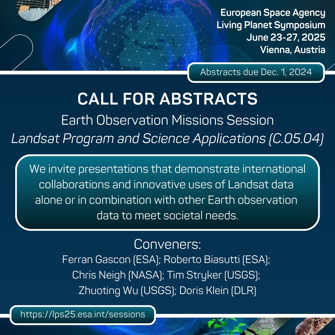
The next @esa Living Planet Symposium is set for June 23-27, 2025, in Vienna, Austria. Call for abstracts are open! Consider submitting an abstract under Session C.05.04 – Landsat Program and Science Applications. Learn more here: ow.ly/inXA50U5FMm #LPS25 #Landsat
#OTD in 2001, the world was introduced to the first #EarthAsArt collection. An inaugural exhibit at the Washington Pavilion in #SiouxFalls, South Dakota showcased a unique selection of stunning #Landsat 7 images. Watch the full Earth As Art 1 video here: ow.ly/hwIA50U3kHi
The #HenryMountains in #Utah hold a unique distinction in American history. They were one of the last mountain ranges in the lower 48 to be named. It wasn’t until 1872 that they were named after Joseph Henry, a great American scientist. Learn more here: ow.ly/Wf6Q50U2y8s

While #Landsat calibration might not be the most glamorous topic to bring up in a casual conversation, it is an essential process that underpins exceptional #DataQuality. A new USGS Fact Sheet highlights Landsat’s calibration activities. Check it out here: ow.ly/1zhG50U1zNx

Annual NLCD, released on October 24, 2024, is a new product suite that covers 39 years of #LandCover and land cover change, all thanks to the #Landsat archive. Listen to the latest Eyes on Earth podcast episode to learn more: ow.ly/UsKg50TZqxG
Read all about it! 🗞️ The October #Landsat newsletter is here with insights on wildfire monitoring, water resources, atoll temperatures, and more. Subscribe to get the latest on all things Landsat: go.nasa.gov/3UIqQ0O

#MountLewotobi Laki-laki, located on Flores Island in #Indonesia, erupted before midnight on Sunday, November 3, 2024. The powerful eruption spewed explosive plumes of lava, rock, and ash that blanketed nearby villages, damaged structures, and claimed at least 10 lives. #Landsat
#LandsatPublication: A new Special Issue in #RemoteSensing aims to cover all #Landsat 9 calibration and validation activities that have been performed to date to ensure that Landsat remains the gold standard of global land imaging. Access the issue here: ow.ly/zXKw50U0vt3
Happy #StatehoodDay to the Dakotas! On November 2, 1889, #NorthDakota and #SouthDakota joined the United States as the 39th and 40th states. The historic event marked a milestone in the region’s journey. Learn how #Landsat benefits these states here: ow.ly/2WTt50TYmhI


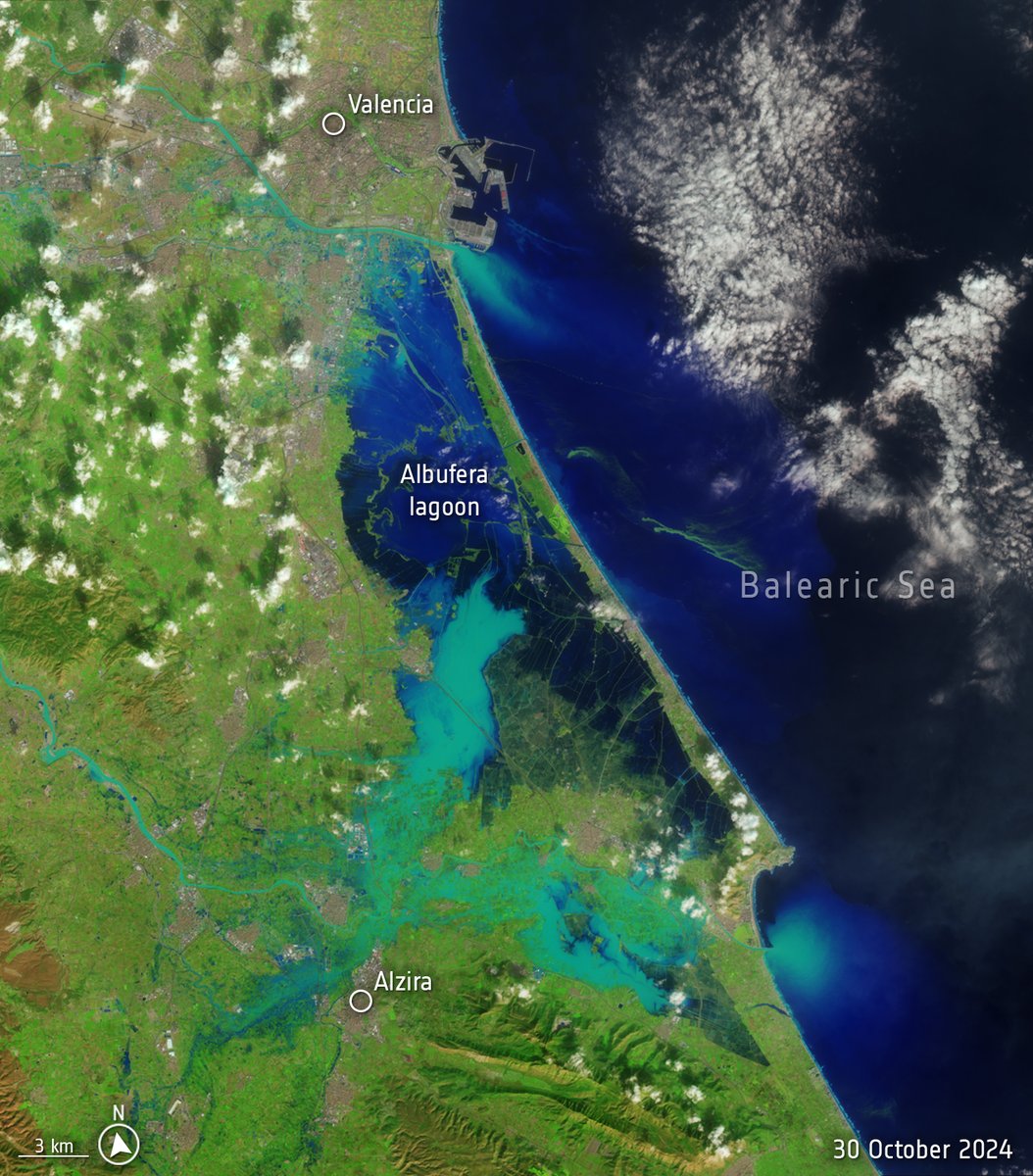
Torrential rainfall and catastrophic flooding have devastated the Valencia region of #Spain. Reports indicate that some communities recorded more than 400 mm (16 inches) of rainfall, or nearly the equivalent of a year’s worth of precipitation, within just eight hours. #Landsat
After retiring in 2013 as the longest-operating Earth-observing satellite, #Landsat 5 was lowered 22.9 km into a graveyard orbit. 🪦 It will drift towards Earth until eventually re-entering and burning up in Earth’s atmosphere. #NASAHalloween
Spain is suffering its worst flood in decades after torrential rains struck the eastern province of Valencia. The death toll is climbing and people remain missing. 📸These images from Landsat-8 satellite illustrate the scale of the disaster, with images from October 8 and…

Skyline Drive looks equally stunning from space! 🍁 The Thematic Mapper (TM) on #Landsat 5 captured this fall foliage image in October 2010. go.nasa.gov/3YzjTS2

Fall is the most popular time to travel along Skyline Drive in @ShenandoahNPS, with its colorful foliage and opportunities to view some of the most scenic vistas in the eastern United States.

This Halloween, eerie “ghost forests” haunt the coast of North Carolina. 👻 Droughts, hurricanes, and sea level rise have transformed green forests into desolate, skeletal landscapes, with pale, barkless trees lining the waterways like tombstones. go.nasa.gov/4f3La5Y
United States Trends
- 1. $MAYO 8.862 posts
- 2. $CUTO 7.414 posts
- 3. Tyson 370 B posts
- 4. Laken Riley 32,8 B posts
- 5. Pence 41,2 B posts
- 6. Dora 21,6 B posts
- 7. Ticketmaster 15,4 B posts
- 8. Cenk 8.706 posts
- 9. Mike Rogers 4.794 posts
- 10. Mr. Mayonnaise 1.287 posts
- 11. #FursuitFriday 15 B posts
- 12. Pirates 17,2 B posts
- 13. The UK 423 B posts
- 14. Iron Mike 15,2 B posts
- 15. DeFi 105 B posts
- 16. Kash 63,6 B posts
- 17. Scholars 10,5 B posts
- 18. Oscars 13,4 B posts
- 19. #AmericaRecyclesDay N/A
- 20. #FridayMotivation 3.906 posts
Who to follow
-
 NASA Landsat
@NASA_Landsat -
 Earth Observation Lab
@HumboldtEOLab -
 Remote Sensing MDPI
@RemoteSens_MDPI -
 NASAEarthdata
@NASAEarthData -
 ESA Earth Observation
@ESA_EO -
 Copernicus EU
@CopernicusEU -
 Geography Realm
@Geographyrealm -
 USGS EROS
@USGS_EROS -
 Justin Braaten
@jstnbraaten -
 Sentinel Hub
@sentinel_hub -
 GEDI
GEDI
@GEDI_Knights -
 NASA Earth
@NASAEarth -
 Mike Wulder
@mikewulder -
 Qiusheng Wu
@giswqs -
 Copernicus Land Monitoring Service
@CopernicusLand
Something went wrong.
Something went wrong.

