Vaaris
@VRPWeatherAspiring 14-Year Old Weather Enthusiast 🌧️❄️🙂| Always Learning | DM Me for Any OFFICIAL Licensing 📄 Subscribe to my YT- https://t.co/rzlrC5aJXz
Wild Card Number One is showing up for the winter.
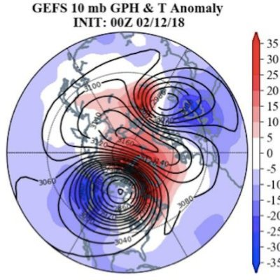
The ECMWF operational model is predicting such a beautiful stretched #PolarVortex (PV) it inspired a Batman & Robin meme. Maybe like the GFS long range fantasy snowstorm, the ECMWF is into long-range fantasy PVs but that would kick off #winter in the Eastern US with a real bang.


It's safe to say next weeks ULL will be the big pattern changing system (Nov 20-23rd). Nice -EPO, +PNA & -NAO will all work to drive cold into the eastern half of CONUS. Snow potential should come thanksgiving week as the -NAO attempts to break down as the cold air is established


The ECMWF operational model is predicting such a beautiful stretched #PolarVortex (PV) it inspired a Batman & Robin meme. Maybe like the GFS long range fantasy snowstorm, the ECMWF is into long-range fantasy PVs but that would kick off #winter in the Eastern US with a real bang.


*If* we get a pattern like this around thanksgiving, it would be supportive for snow in the eastern half of the US. A strong blocking high (-NAO), plus a -EPO & riding over Alaska pouring cold into CONUS. This is the GFS & its 318 hrs out, but all signs point to a pattern change.

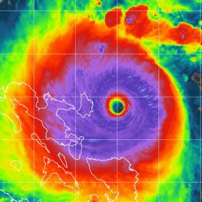
Hurricane Rafael is impacting Cuba very hardly right now, the storm looks to move into the gulf but also, fortunately, to weaken. That being said anything can change and so all monitors along the Gulf coast especially near Texas/Mexico should be on the look out!!⚠️

For everyone working the night shift, we see you 🫶☕️🕐
An NWS Pittsburgh forecaster has been spotted waiting for rain by our rain gauge.

We just can’t shake that -PNA
Keep an eye on the snow cover in Siberia this month. If there is extensive snow in Siberia in October, the Siberian High will become stronger. This would create a better chance for arctic air masses to move into the US this winter. Yes, it's all connected! 👇❄️🚂

ENSO 3.4 has been stubbornly warm compared to all long-range model forecasts made since September 2023. CPC calls for a nearly 80% chance at La Nina for the early winter months while the modeling suggests a 50/50 toss up between La Nina and La Nada.

who let the weather channel name winter storms 😭🙏

Hey everyone! Sorry I couldn't post this weekend0 had make-up work and a big XC meet. Will be back this weekend (GET ME TO 500 ON YT!!!!)
A severe geomagnetic storm could make the northern lights visible in parts of the U.S. tonight ⬇️

Dare I say…tonight’s Aurora could be the most widely viewed Northern Lights show in our lifetimes. A G4 Magnetic Storm with a Kp index of ~8 means we could have an overhead Aurora visible to the naked eye as far south as New Jersey/Pennsylvania/Ohio! #wxtwitter #wxX #Aurora…

Prayers up for all affected by Milton. So so so so sorry that I couldn’t get an update out. 🙏❤️
United States Trends
- 1. Travis Hunter 11,7 B posts
- 2. Arkansas 28,6 B posts
- 3. Heisman 5.144 posts
- 4. Ewers 2.088 posts
- 5. Northwestern 6.324 posts
- 6. $CUTO 8.259 posts
- 7. Carnell Tate 1.606 posts
- 8. Colorado 67,8 B posts
- 9. Sheppard 2.933 posts
- 10. Sark 1.824 posts
- 11. Jeremiah Smith 1.310 posts
- 12. Caleb Downs N/A
- 13. Isaac Wilson N/A
- 14. #HookEm 2.645 posts
- 15. Denzel Burke N/A
- 16. Shedeur 3.770 posts
- 17. Wrigley 3.858 posts
- 18. #Buckeyes N/A
- 19. Arch 15,6 B posts
- 20. #SkoBuffs 3.571 posts
Something went wrong.
Something went wrong.


