TYC GIS Training
@tycgis_EnglishGIS, Remote Sensing and Cartography Solutions. Experts in GIS Training.
Similar User

@TerraGo

@Geo_EDINA

@tarheelgis

@geomattsheehan

@JurjigisBcn

@bcsgis
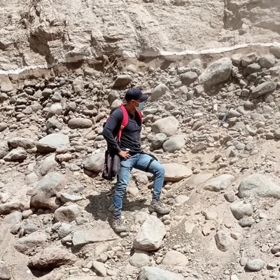
𝗧𝗬𝗖 𝗚𝗜𝗦 provides a new training in professional applications of drones and GIS with euroMind in Malaga for a group of students from technical schools of Toruń y Łomża (Poland). #GIS #drones #formación #training Contáctenos: 📧 formacion@tycgis.com 📱 +34 635 619 882

🧑🎓What you will learn in the new ArcGIS Pro Beginner Level Course TYC GIS’s new ArcGIS Pro Beginner Level Course will introduce you to ArcGIS Pro, ESRI’s most recent Desktop GIS application. Link: giscourse.com/arcgis-pro-cou…

💻🐍 In this post we are going to learn how to merge massive amounts of raster files automatically using PyQGIS. Link: giscourse.com/automatically-… #Python #QGIS #PyQGIS

Hello everyone! TYC GIS team would like to inform you that our online courses are still active. Our trainers, in remote mode, are ready to answer all your questions. The training goes on!

Download OpenStreetMap data using QuickOSM plugin in QGIS 3.4 Madeira giscourse.com/download-opens…
ArcGIS Course, From Beginner to Advanced level - Online GIS Training giscourse.com/arcgis-10-cour…
Digital Mapping with ArcGIS 10.x and Autocad Map 3D - Online GIS Training giscourse.com/arcgis-10-cour…
HecRas and ArcGIS 10.x Course for Hydraulic Modelling (GEORAS) - Online GIS Training giscourse.com/arcgis-10-cour…
Download OpenStreetMap data using QuickOSM plugin in QGIS 3.4 Madeira giscourse.com/download-opens…
QGIS COURSE BEGINNER TO ADVANCED LEVEL🌏 Start date: 11TH OF FEBRUARY If interested email us at: training@tyggis.com giscourse.com/qgis-courses/q…">giscourse.com/qgis-courses/q… giscourse.com/qgis-courses/q…">giscourse.com/qgis-courses/q…
QGIS COURSE ADVANCED LEVEL🌏 Start date: 12TH OF FEBRUARY If interested email us at: training@tyggis.com giscourse.com/qgis-courses/q…">giscourse.com/qgis-courses/q… giscourse.com/qgis-courses/q…">giscourse.com/qgis-courses/q…
QGIS COURSE BEGINNER LEVEL🌏 Start date: 11TH OF FEBRUARY If interested email us at: training@tyggis.com giscourse.com/qgis-courses/q…">giscourse.com/qgis-courses/q… giscourse.com/qgis-courses/q…">giscourse.com/qgis-courses/q…
HECRAS AND ARCGIS 10.x COURSE FOR HYDRAULIC MODELLING (GEORAS) 🌏 Start date: 15TH OF FEBRUARY If interested email us at: training@tyggis.com giscourse.com/arcgis-10-cour…
DIGITAL MAPPING WITH ARCGIS 10.x AND AUTOCAD MAP COURSE 🌏 Start date: 13TH OF FEBRUARY If interested email us at: training@tyggis.com giscourse.com/arcgis-10-cour…">giscourse.com/arcgis-10-cour… giscourse.com/arcgis-10-cour…">giscourse.com/arcgis-10-cour…
United States Trends
- 1. Jokic 10,4 B posts
- 2. Pete 275 B posts
- 3. DeSantis 32 B posts
- 4. Kerr 6.296 posts
- 5. Mavs 11,3 B posts
- 6. Clemson 24,3 B posts
- 7. Kentucky 18,7 B posts
- 8. Podz 2.805 posts
- 9. Wiggins 2.604 posts
- 10. Brea 2.518 posts
- 11. Jamal Murray 1.364 posts
- 12. Marcus Smart 2.431 posts
- 13. Bama 40,2 B posts
- 14. Kuminga 2.130 posts
- 15. Grizzlies 5.948 posts
- 16. #MFFL 3.782 posts
- 17. Miami 114 B posts
- 18. Knicks 15,1 B posts
- 19. NBA Cup 13,4 B posts
- 20. Luka 28,6 B posts
Something went wrong.
Something went wrong.


