Similar User

@IvayloG98914814

@BoydMachinery

@agalabs_india

@Photonics_Guy

@JethwaniAshwin

@Chad_Hemmer

@FuturesPicks

@Avery_Farming

@RahCattell

@me_NareshJain

@wxturch

@MohdShamy

@Houdard3

@aihazuuu

@CorinTrade
Russians were braving some of the hottest weather seen in more than a century with Moscow breaking a 1917 record and cities across the world's biggest country sizzling in temperatures well above 35 degrees Celsius reut.rs/45TAxi8
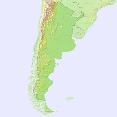
Approximate percentage of precipitation that falls as snow throughout the year based on 1991-2020 normals.

The El Niño of 2023-24 is weakening across the tropical Pacific and forecasters expect that La Niña will develop sometime this summer. What could that mean for our summer and fall climate? Read more about this month's forecast: bit.ly/ENSOApril2024
Three days after the disastrous eruption of the #HungaTonga #volcano, #Tonga remains isolated ⬇️The impact of the eruption on Kanokupolu, on Tongatapu island, is visible when comparing #Sentinel2 🇪🇺🛰️ images of ↙️ 8 Dec. 2021 (before) and ↘️17 Jan. 2022 (after the 🌋)

#NASAWorldview Image of the Week: Explosive Eruption of #HungaTonga - Hunga Ha'apai Volcano as observed on Jan. 15, 2022 by the ABI instrument aboard the @NOAA GOES-West satellite. Learn more: go.nasa.gov/3fFO8Ak GeoColor Imagery provided by NOAA/NESDIS/STAR
An animation showing multiple acquisitions over #HungaTonga in the past month. As the image captured on 2 January shows, the island grew in size due to intense volcanic activity prior to the eruption. The last frame is the latest @CopernicusEU #Sentinel2 image from 17 January.
YES! This is a GFS Prediction so we'll have to see how this plays out. BUT this is what a split of the Stratospheric Polar Vortex looks like, 3-dimensionally! In this case, the vortex splits into three separate vortices. Very cool!
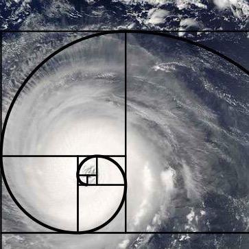
The huge eye of Category 5 Hurricane #Irma completely engulfed the island of Barbuda last night, captured by the Suomi NPP #VIIRS overpass.

Before everyone goes hunting for the highest model QPF, here's a history lesson on observed MAX rainfall from TCs (data by @DRmetwatch)

The Arctic and Antarctic had something in common in March 2017: record-low sea ice extents. go.usa.gov/xXkwh
United States Trends
- 1. Mike 1,8 Mn posts
- 2. Serrano 240 B posts
- 3. Canelo 16,6 B posts
- 4. #NetflixFight 72,5 B posts
- 5. Father Time 10,8 B posts
- 6. Logan 79,3 B posts
- 7. #netflixcrash 15,9 B posts
- 8. He's 58 26,2 B posts
- 9. Rosie Perez 14,9 B posts
- 10. ROBBED 102 B posts
- 11. Boxing 301 B posts
- 12. Shaq 16,2 B posts
- 13. #buffering 10,9 B posts
- 14. My Netflix 83,3 B posts
- 15. Roy Jones 7.187 posts
- 16. Tori Kelly 5.263 posts
- 17. Ramos 70 B posts
- 18. Muhammad Ali 18,6 B posts
- 19. #netfilx 5.074 posts
- 20. #cancelnetflix 5.080 posts
Who to follow
-
 Ivaylo Georgiev
@IvayloG98914814 -
 Boyd & Sons
@BoydMachinery -
 agAlabs
@agalabs_india -
 Todd Wangsness
@Photonics_Guy -
 AD Commodities
@JethwaniAshwin -
 ABCL INC.
@Chad_Hemmer -
 Lyceum
@FuturesPicks -
 Richard Avery
@Avery_Farming -
 Rah Cattell
@RahCattell -
 Naresh Jain
@me_NareshJain -
 Adam Turchioe
@wxturch -
 Shamy
Shamy
@MohdShamy -
 Christelle Houdard
@Houdard3 -
 🇵🇸✨
🇵🇸✨
@aihazuuu -
 Corin Commodity
@CorinTrade
Something went wrong.
Something went wrong.


