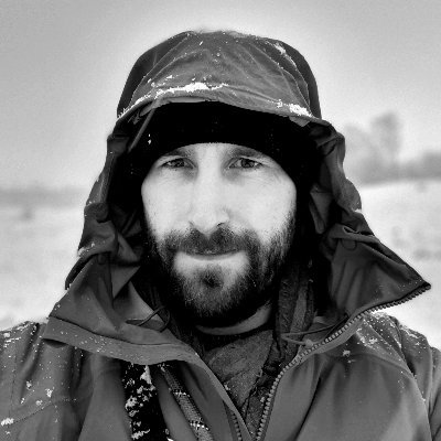
Javier de la Torre
@jatorreBiodiversity Informatics, Location Intelligence, Spatial Analytics, Spatial Data Science, Founder & CSO at @CARTO
Similar User

@CARTO

@postgis

@Mapbox

@Vizzuality

@saleiva

@kelsosCorner

@michalmigurski

@andrewxhill

@mamataakella

@opengeospatial

@mappingmashups

@pwramsey

@hotosm

@javisantana

@geoawesome_dgtl
The power of vector maps become really clear when presenting with a massive 4K projector

Check out this @streamlit app from @CARTO carto-demo-wildfires.streamlit.app It shows a hex heatmap of wildfire risk in California, plus nice human-readable explanations generated using @SnowflakeDB Cortex AI. And it's open source! Click the Github link in the top right to view the code.
Happy Birthday OSM, we have been implementing the mapping project since 2011 using OSM in Indonesia. From 100 buildings to 40 billions building with more than 36.000 volunteer mappers. So wonderful can gain the journey my carrier development through promote the open mapping with…
Just a few days for our community event with deck.gl and CARTO in San Francisco. Come join Chris Gervang and I for an evening of data visualization and maps! lu.ma/dqrjkwop
Great news! Overture data is now available on BigQuery and Snowflake, allowing direct access and simplified integration into your existing workflows. Try them out and share your thoughts with us: hubs.la/Q02vRK4B0 A big shout-out to @CARTO for making this possible.

Congrats guys on the paper. Love to see @CARTO on the references :) clausa.app.carto.com/map/b7ed107c-a…

Deforestation substantially contributes to GHG emissions globally. But what drives forest loss? Our new study published today in @GEC_Journal uses deep learning on satellite imagery to identify the drivers of >2 million forest loss events🛰️🌲 Paper: authors.elsevier.com/a/1iveH3Q8oQKs…
Our 2 cents!! Con @jatorre @enriquelinares y @ojuncosa blogs.elconfidencial.com/tecnologia/tri…
Such a good time at #sdsc23! Thanks to everybody for passing by! My 3 highlights: Towards a triggered based, real time spatial analysis. How? 1. The Data Cloud: with geoparquet! 2. H3: A single support system to UNION ALL 3. Generative AI: With conversational maps

It's official - @jatorre is a Swiftie! So cool to see my map featured in his epic #SDSC23 keynote!! 🗺️

Lo conseguimos! - we made it! @intaespana Per aspera, ad astra! #VamosMIURA (📷@manumazzanti)

We are partners of the year at Google Next 2023!

Hey whatsapp, you forgot to add the credit card on google maps

Talk to the map. How we are applying GenAI to geo at @CARTO if you are next week in San Francisco we are giving demos at our booth at Google Next. cloud.google.com/blog/products/…

Just out of curiosity. OpenAI functions is just convenient prompt engineering? You could describe your api on the context and achieve same results without them? Will Langchain provide similar capabilities on other LLMs? Is there something special I am missing?
This red line might as well be from another planet. We are living the last days of Earth and human civilisation as we had come to know them. A tiny bit of ice left in the Arctic is currently keeping temps from rocketing. Once it goes, things will be simply surreal #ClimateCrisis

We are looking for a Senior Frontend Engineer to join @CARTO to work on CARTO Builder. Our flagship product to visualize and analyze geospatial data, based on kepler.gl and deck.gl. More info: jobs.lever.co/cartodb/c1bb7e…

My keynote on our Spatial Data Science Conference got published. All about how generative ai will impact spatial analytics: youtu.be/6DtZ67C6A4Y It was a great conference where AI and H3 where the top discussions. Thanks everybody who joined us!


United States Trends
- 1. Cowboys 5.027 posts
- 2. Cowboys 5.027 posts
- 3. #WWERaw 47,6 B posts
- 4. Mixon 11,4 B posts
- 5. Pulisic 11,6 B posts
- 6. Cooper Rush 7.360 posts
- 7. Turpin 2.713 posts
- 8. #USMNT 2.742 posts
- 9. #HOUvsDAL 5.934 posts
- 10. #AskShadow 5.305 posts
- 11. Zach Lavine 1.667 posts
- 12. #MNFxESPN N/A
- 13. Bray 3.324 posts
- 14. Sheamus 1.941 posts
- 15. Weah 1.801 posts
- 16. Jake Ferguson 1.211 posts
- 17. Bruins 4.201 posts
- 18. Trey Lance 1.365 posts
- 19. Skenes 13,9 B posts
- 20. Mike McCarthy 1.110 posts
Who to follow
-
 CARTO
CARTO
@CARTO -
 PostGIS
@postgis -
 Mapbox
@Mapbox -
 Vizzuality
@Vizzuality -
 saleiva
@saleiva -
 Nathaniel V. KELSO
@kelsosCorner -
 @[email protected]
@michalmigurski -
 Andrew Hill
@andrewxhill -
 Mamata Akella
@mamataakella -
 Open Geospatial: OGC
@opengeospatial -
 Alan McConchie subdued.social/@alan
@mappingmashups -
 Paul Ramsey
@pwramsey -
 Humanitarian OpenStreetMap Team
@hotosm -
 javi santana
@javisantana -
 Geoawesome
@geoawesome_dgtl
Something went wrong.
Something went wrong.


