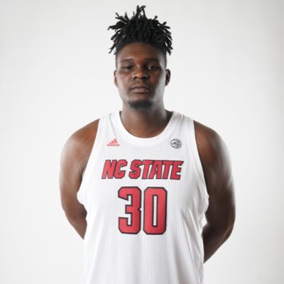
Nicholas Boynton
@WxBoyntonMajor in Meteorology at NC State ‘24 / Avid weather enthusiast / Gym enthusiast / Weekend Evening Meteorologist @ WSIL-TV in southern Illinois!
Similar User

@jackendrickwx

@cory_kowitz

@EthanClarkWX

@Jayismyname1707

@ncwxauthority

@RaleighWx

@backinblack_wx

@weather_history

@SethMonteith150

@LeeRingerWx

@katcampbellwx

@LarryCosgrove

@NCWeatherhound

@weathermodels_

@PivotalWeather
KaVontae Turpin just put the Commanders entire kick team in the spin cycle
99 YARDS TO THE 🏡 @KaVontaeTurpin was gone!! 📺: #DALvsWAS on FOX 📲: Stream on NFL+ bit.ly/3WIc77m
After a mild Sunday, a cold front will bring a chance of light rain Monday followed by colder temperatures Tuesday. Another disturbance will bring a chilly and rainy Thanksgiving to the region. Even colder temperatures are expected after Thanksgiving into early December.

Temperatures will trend warmer this weekend ahead of a cold frontal passage Monday. Rain is possible Monday and for the Thanksgiving holiday. Cold weather is becoming likely for the end of November/start of December.

Chilly tonight, warming trend this weekend into Monday. Light rain chances Monday into Monday evening, then much cooler conditions for mid to late week. Better rain chances arrive Wednesday and will continue through Thanksgiving.

Confidence is growing that a wave a well-below normal temperatures will impact the region to open December. The coldest temperatures of the season by far and possibly single digit wind chills are possible during this time. Check back for updates in the coming days!

New satellite image for meteorology textbooks just dropped. Incredible view at sunset.

Winterizing your vehicle is an essential part of winter weather preparedness. By spending some time now to make sure your vehicle is in tip top shape, will go a long way to keeping you safe this winter season.

The NWS in Paducah, KY, has changed its extreme cold weather products. Wind chill advisories are now renamed cold weather advisory. The wind chill warnings are now called extreme cold warnings. These products can now be issued for very cold temperatures and/or wind chills.

Beautiful photo captured by a local Midwest photographer today at 4:55pm

NC State true freshman CJ Bailey: 🐺 18/20 passing 🐺 234 passing yards 🐺 3 passing TDs 🐺 0 turnovers 🐺 59-28 victory

A line of storms moves into southeast MO before dawn on Halloween. This line of storms will progress eastward across the region during the day and into the early evening hours. Damaging wind gusts may be possible with the strongest storms.

“We will call it Raleigh-Durham International Airport.” Named for the city of Raleigh-Durham, sir? “It’s actually two different cities.” And which one will the airport be in? “Morrisville.”

Concert for Carolina 💪

It's here!! Peak fall color this week upcoming in Virginia's Blue Ridge Mountains 🍁🍂🍁 Check out this crystal clear satellite pass from yesterday (Thursday) showing the extent of color.


Grayson McCall has retired from football


The inland wind swath accompanying Helene was probably one of the most severe seen with any modern weather event. I've plotted the swath of ERA5 modeled 10m wind gusts (in the cod.edu format) contouring at 75 and 100mph. This stuff just doesn't happen!

A lot of focus on inland flooding with Helene, but treefall from inland wind seems to have caused mortality nearly unprecedented in the modern era. Probably need to wait for the TCR for fatality breakdown by type, but a historic inland storm for wind and rain both.
United States Trends
- 1. Rams 21,3 B posts
- 2. Eagles 41,1 B posts
- 3. #RHOP 4.465 posts
- 4. #PrizePicksMilly 3.450 posts
- 5. #BaddiesMidwest 3.776 posts
- 6. 49ers 37,2 B posts
- 7. #married2med 1.870 posts
- 8. #YellowstoneTV 1.536 posts
- 9. Dinwiddie 2.834 posts
- 10. Raiders 35,2 B posts
- 11. Packers 39,1 B posts
- 12. Niners 7.757 posts
- 13. Broncos 26,1 B posts
- 14. Jared Verse N/A
- 15. Bo Nix 11,4 B posts
- 16. Cowboys 61,1 B posts
- 17. Slay 42,6 B posts
- 18. AJ Brown 1.587 posts
- 19. Josh Jacobs 6.200 posts
- 20. Go Birds 7.975 posts
Who to follow
-
 Jack Kendrick
@jackendrickwx -
 Cory Kowitz
@cory_kowitz -
 Ethan Clark wx
@EthanClarkWX -
 Jay Caceres
@Jayismyname1707 -
 North Carolina’s Weather Authority
@ncwxauthority -
 Allan Huffman
@RaleighWx -
 Brandon Black
@backinblack_wx -
 WX History
@weather_history -
 Seth Monteith ⛈
@SethMonteith150 -
 Lee Ringer
@LeeRingerWx -
 WRAL Kat Campbell
@katcampbellwx -
 LarryCosgrove
@LarryCosgrove -
 Chick Jacobs
@NCWeatherhound -
 weathermodels.com
@weathermodels_ -
 Pivotal Weather
@PivotalWeather
Something went wrong.
Something went wrong.


