Leslie Lowe
@KHQLeslieMy Mom always told me growing up that I better find a job that paid me to talk...so I did! KHQ Lead Weather Forecaster| Mom | Work Out Fanatic| Shoe-a-holic
Similar User

@kxly920

@TheInlander

@KHQSean

@SpokaneArena

@KrisCrockerKXLY

@RobynNanceKXLY

@ClaireGrahamTV

@Mark4NewsNow

@spokanecounty

@KHQLocalNews

@VisitSpokane

@KHQDaveCotton

@jeffchumphrey

@JSwaCoug

@DerekKXLY
Conditions here in #Tampa are going downhill with strong winds and heavy rains as #hurricane #Milton approaches. The @CityofTampa has done a great job of preparing the city and residents are heading the warnings. Stay tuned to @weatherchannel for continuing coverage of Milton.
St Lucie County #Florida Sheriff’s Office struck by tornado ahead of #HurricaneMilton #HurricaneMilton2024
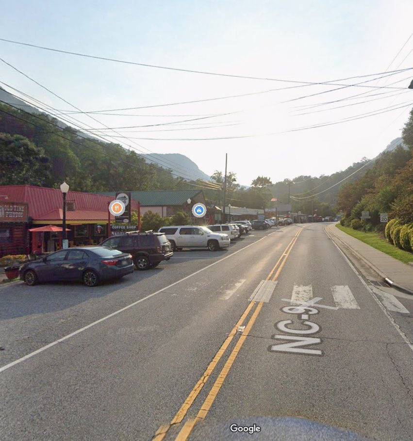
My God. The town of Chimney Rock, NC has been completely wiped out. Pray for North Carolina 🙏🏻

Line of storms moving up from the south is delivering scattered thunderstorms for NE Oregon, Central Washington and more severe storms for Montana, with severe T-Storm watches and warnings. Gusty winds at 25-45 mph are expected as this line pushes north throughout the evening.

40 mph wind gusts at our office over on the West Plains. We're seeing localized visibility reductions down to around 5 miles from dust being lofted from nearby fields.
Ongoing fires are affecting roads across the state. To recap: - SR 20 closed btwn MP 148-157 - US 12 closed btwn MP 151-183 - SR 14 closed btwn MP 133-149 - SR 21 closed btwn MP 106-123 - Keller Ferry limited operation to assist with evacs Follow @wsdot_east for updates


Update on the US 12/White Pass closure The closure point has extended further east. US 12 is closed in both directions at the summit of White Pass (MP 151) to the junction of US 12 & SR 410 (MP 185, "the Y").


You can see on this forecast for near-surface smoke concentration, the several active wildfires that are the source for the smoke many in the western portions of the nation are dealing with today/tonight. Air quality alerts are in effect for many. See if your area is impacted at…
FIRE! SR 904 is closed at I-90 exit 257. The closure extends from I-90 to Ritchey Rd MP 4. Avoid State Route 904 in this location as you will not be allowed through due to a fire in the area. Multiple planes, helicopters & fire personnel are working hard to contain the fire.


#ColumbiaBasin Fire Update | 6:26 PM | The SR 904 closure has been extended roughly three miles to the east, from the I-90 interchange in Tyler to Graham Road.


Heads up, a collision is blocking the right lane of WB I-90 near Division Street in downtown Spokane. Expect delays.
Another new fire in west Spokane near Government Way 🔥 Stay safe!
Pictures of a the wildfire burning in southwest Spokane County sent from our Incident Response Team. No closures to I-90 or SR 904 at this time.


Do you like these cooler temperatures? Well, that's just too bad. Confidence is increasing in the #heat returning for August thanks to a high pressure ridge building in the Southwestern US. #wawx #idwx


Dust storm warning for parts of the upper Columbia Basin near Ritzville. Near zero visibility- life-threatening travel conditions. PLEASE Be safe!

(1 of 2) 1030 AM PST 10/4: Scattered snow showers continue to expand again over portions of north ID & NE WA . Some steadier snow showers are found over northeast Spokane county eastward into Rathdrum Prairie. Watch for slick spots on roads if you encounter snow. #wawx #idwx
Check out this capture of Mammatus clouds in New River, Arizona. These clouds often accompany thunderstorms, but they are harmless, as they don't produce severe weather. They get their structure due to sinking air. #AZwx
United States Trends
- 1. Tyson 536 B posts
- 2. Karoline Leavitt 19,1 B posts
- 3. #wompwomp 7.016 posts
- 4. Paige 7.961 posts
- 5. Syracuse 22,6 B posts
- 6. Pence 62,2 B posts
- 7. Kiyan 27,3 B posts
- 8. Kash 108 B posts
- 9. The FBI 271 B posts
- 10. Jarry N/A
- 11. Debbie 36 B posts
- 12. Frankie Collins N/A
- 13. Whoopi 118 B posts
- 14. #TOKKIVSWORLD 1.894 posts
- 15. #LetsBONK 16,7 B posts
- 16. Dora 24,9 B posts
- 17. White House Press Secretary 22,8 B posts
- 18. Villanova 1.866 posts
- 19. Ace Bailey N/A
- 20. End of 1 23,8 B posts
Who to follow
-
 KXLY 920 News Now
@kxly920 -
 The Inlander
@TheInlander -
 Sean Owsley
@KHQSean -
 Spokane Arena
@SpokaneArena -
 Kris Crocker
@KrisCrockerKXLY -
 Robyn Nance
@RobynNanceKXLY -
 Claire Graham
@ClaireGrahamTV -
 Mark Peterson
@Mark4NewsNow -
 Spokane County
@spokanecounty -
 KHQ Local News
@KHQLocalNews -
 VisitSpokane
@VisitSpokane -
 Dave Cotton
@KHQDaveCotton -
 Jeff Humphrey
@jeffchumphrey -
 Jerry Swanson
@JSwaCoug -
 Derek Deis
@DerekKXLY
Something went wrong.
Something went wrong.


