Sebastian Silva
@FanzineGeoFocus on conflicts & geopolitics + aesthetic explorations. RT of interesting geospatial news.
Similar User

@Itohan_Osa_

@hadallen2

@citysbackyard

@aopinillap

@GeoMahdi

@C1audiuMarin

@ClarkGeomatics

@krvrd

@curious_Fabian
The most important concept in the open-source geospatial world? Linus's Law. Here's what you need to know about it:

La carte (et la géographie) comme outil de promotion du territoire national Exemple : le Chili et sa carte officielle tri-continentale proposée comme ressource éducative sur le Portail national des programmes d'études du Chili curriculumnacional.cl/estudiantes/Ed… 1/

We are making the videos for our course on data visualization with Google #EarthEngine available to everyone for self study. Access the complete playlist with ad-free videos at youtube.com/playlist?list=…
Releasing a new Google #EarthEngine workshop titled "Creating Publication Quality Charts with GEE" with completely open materials and code. A structured guide to help you create beautiful and informative visualizations from climate and earth observation datasets. A thread (1/n)👇

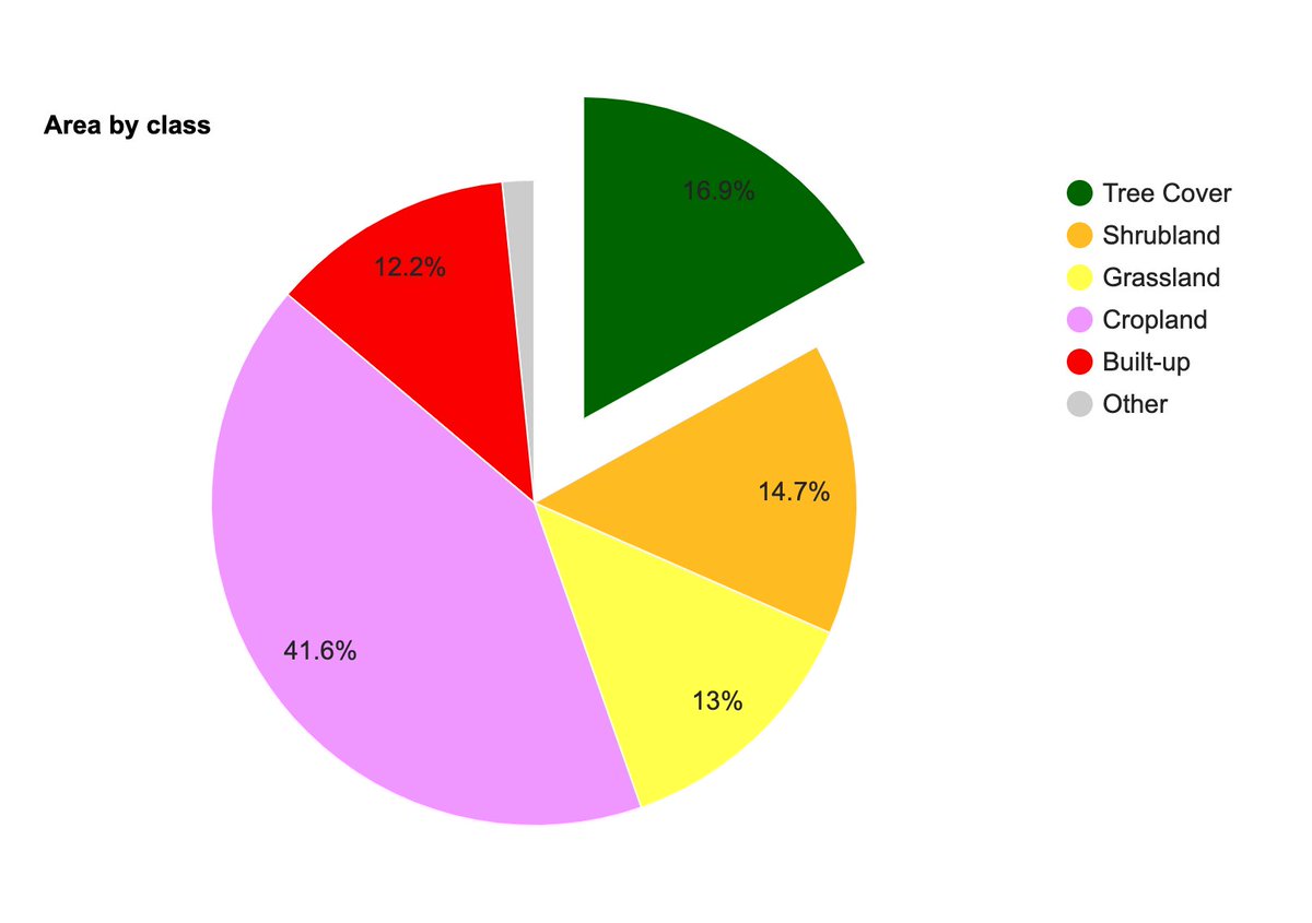
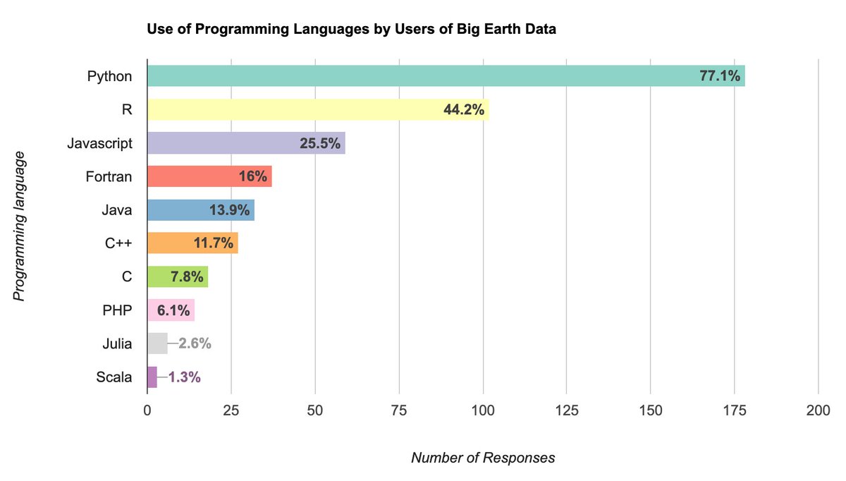

The best resources to go from beginner to advanced in GIS. PLUS free geospatial data to measure international trade, no-code geospatial tools and more. Here's everything I wrote about this week:

Check the new Conflict Exposure data available in the ACLED database. acleddata.com/conflict-expos…


🟠 Burn scars of the recent fires🔥 near Viña del Mar, #Chile🇨🇱 5 February 2024 #Landsat-8🛰️ Full-size ▶️ flic.kr/p/2pwMyfG #OpenData #SciComm Image is about 32 kilometers wide #ViñadelMar #fire #wildfire

Intencionalidad Incendio Abro hilo con análisis realizado por @Atisba_Urb para detectar posibles zonas de origen intencional del fuego. Se usaron mapas térmicos de FIRMS Nasa + registro histórico de siniestros (10 años), que muestra ataques recurrentes en barrios destruidos
🆕ACLED #ConflictIndex: 2024 Update Drawing on the latest data and patterns, our newly updated Index assesses levels of conflict according to 4 key indicators: deadliness, danger to civilians, geographic diffusion, and fragmentation. acleddata.com/conflict-index/ Key Takeaways ⤵️

Today's Ultra Hi-Res SAR image of the day features Zermatt, Switzerland ⛷️🏂🎿 | 4x-looked 1m

Informative animation by @sdbernard using @ACLEDINFO data to visualize the frequency, magnitude & spatial distribution of violent attacks across the Sahel for @aanuadeoye's latest Big Read for the @FinancialTimes on the ongoing jihadist insurgency: ft.com/content/f9c0ca…
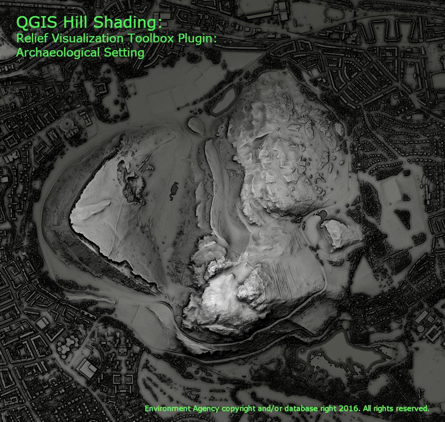
I did a comparison of the different hill shading tools in #QGIS and got some amazing results. Each one was blended with a DTM to give a bit of depth. Have a look at this thread for details on the 7 ways I tried, these are the most interesting. 1/n
🗺 Farewell, orange highways. The latest updates to the Google Maps color scheme mark the end of an era in digital cartography. Gray and blue now rule the cartography scene, as 6 of the top digital map providers all use a shade of gray or blue to represent highways. Just like…

Very interesting approach by these researchers to assess damage to #Ukraine's agricultural land from Russia's invasion, demonstrating "the power of multi-temporal spectral analytics for environmental damage assessment" in conflict-affected areas sciencedirect.com/science/articl…

Quick 🧵 on Turkey not allowing #Ukraine’s 2 new Sandown Class mine hunters to sail to Black Sea Lots of emotion on here Yet this is such a non-news, here’s why..

Corruption effects on Chinese nuclear buildup: "missiles filled with water instead of fuel and vast fields of missile silos in western China with lids that don’t function in a way that would allow the missiles to launch effectively." bloomberg.com/news/articles/… Possible crime scene:

25 Satellite Maps To See Earth in New Ways - GIS Geography gisgeography.com/satellite-maps/
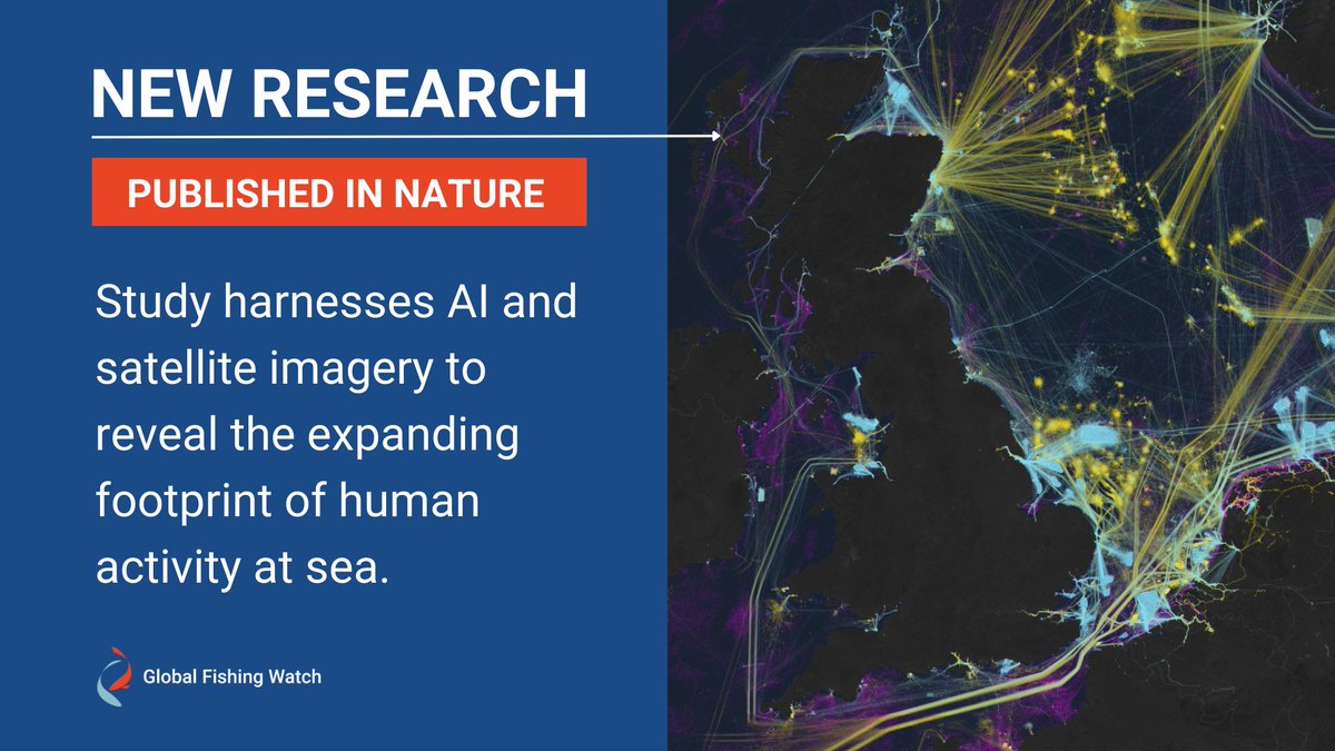
🚨In our new study in @Nature 🚨 we processed 2 million GB of satellite images to identify fishing vessels, nonfishing vessels and fixed infrastructure across the ocean over 5 years. Remarkably, we find that 75% of the world’s industrial fishing vessels are not publicly tracked.

📢 JUST PUBLISHED: @GlobalFishWatch leads groundbreaking study in @Nature that illuminates the expanding footprint of human activity at sea. 🛰️ The novel research provides an unprecedented view of previously unmapped industrial use of the ocean. 🌐 bitly.ws/38yJc
The biggest problem of using satellite data to predict pixel-level GDP? The lack of ground truth data to train models on. Now, there's a promising solution: human-machine collaboration. Here's what you need to know about it:

United States Trends
- 1. #TuesdayFeeling N/A
- 2. Good Tuesday 23,5 B posts
- 3. #tuesdayvibe 2.378 posts
- 4. Jameis 56,9 B posts
- 5. Elvis 16,3 B posts
- 6. Broncos 70,4 B posts
- 7. Browns 59 B posts
- 8. Delaware 66,4 B posts
- 9. #GivingTuesday 13,8 B posts
- 10. Bo Nix 20,4 B posts
- 11. Jeudy 30,2 B posts
- 12. Big E 59,6 B posts
- 13. Watson 20,8 B posts
- 14. #SkeletonCrew 11 B posts
- 15. #ncwx N/A
- 16. Kofi 32,7 B posts
- 17. Roddy 4.132 posts
- 18. Levi Wallace 5.970 posts
- 19. Manfred 4.299 posts
- 20. Vermont 14,8 B posts
Something went wrong.
Something went wrong.

