DixieChasing
@DixieChasing22 + Weather Enthusiast ⛈🌪+ severe weather coverage & news + AL raised
Similar User

@jameshannumWx

@JonahJonesWX

@AndrewOstapowi1

@theresonly1JD

@_TheBoy_25
Hurricane Milton will hit Cat 5 strength later this evening with pressure at 935 mb. It will also continue to strengthen. This thing is mind blowing the ceiling for this is insane. Look at satellite 🤯🌀👀👀🌀 #wxtwitter #HurricaneMilton #Milton #flwx

12Z Euro ensemble members have mostly shifted northward, but we won't have a idea of where the tropical system goes until it actually forms. Watching trends closely 👀🌀🌀 #hurricane #flwx #tropicalstorm #sara #wxtwitter

HURRICANE RAFAEL continues to rapidly intensify as it barrels its way to Cuba later today. It is projected to do a very rare thing today which is make landfall as a major hurricane in November 🤯👀🌀 #wxtwitter #hurricanerafael #Rafael
I sure hope Pea ridge ARK didnt take a direct hit from this monster tornado big time debris fall out showing up on radar now🚨🌪️😲 #tornado #wxtwitter #arwx

Monster tornado on the ground near little flock ARK. Moster CC drop with damage being reported get to shelter now as this heads towards Garfield/Pea Ridge ark🚨🌪️ #arwk #tornado #wxtwitter

Big time tornado on the ground with a monster cc drop as it heads towards Ballard ok about to cross into Ark. get to shelter 🚨🚨🌪️🌪️ #wxtwitter #tornado #arwx #okwx

Likely a big tornado on the ground near Sanders Ok. Seek shelter now 🚨🌪️👀 #wxtwitter #tornado #okwx @NWStulsa

Tropical storm Rafael has officially formed and is expected to intensify some what rapidly as it tracks towards the gulf. Potentially reaching Cat 2 as it goes towards Cuba. How strong it gets in gulf is still uncertain. Paying close attention 👀🚨🌀 #wxtwitter #rafael #alwx #wx
This is likely a big tornado on the ground it should miss Plainview but likely heading straight towards Danville ARK. Seek shelter🚨🌪️#wxtwitter #arwx #tornado

Confirmed on the ground now! #wxtiwtter #arwx #tornado


Tornado likely on the ground heading towards Plainview Arkansas. Very big uptick in circulation & now a debris sig starting to show on radar🚨🌪️ #wxtwitter #arwx #tornado @NWSLittleRock


Tornado likely on the ground heading towards Plainview Arkansas. Very big uptick in circulation & now a debris sig starting to show on radar🚨🌪️ #wxtwitter #arwx #tornado @NWSLittleRock


PDS TORNADO WARNING HEADING TOWARDS WATOVA OKLAHOMA. GET TO SHELTER NOW 🚨🌪️ #wxtwitter #tornado #okwx @NWStulsa

Watching this supercell really closely near Talala OK. Heading towards Jamestown. Really strong convergence coming together on velocity scans. Watch out if your in the path! 🚨🌪️#wxtwitter #tornado #okwx


Confirmed Observed tornado on the ground. Near wynnewood Oklahoma. Heading towards Stratford OK. Take shelter now 🚨🌪️ #okwx #tornado #wxtwitter

Dangerous Dangerous day setting. Make sure to follow me for rapid fire updates #wxtwitter #tornado
Radar indicated Tornado Warning for a storm just south of Norman OK Heading towards Wayne Ok. Get to shelter now if your in the polygon. 🚨🌪️ #wxtwitter #tornado #okwx

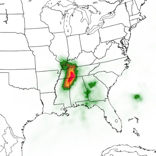
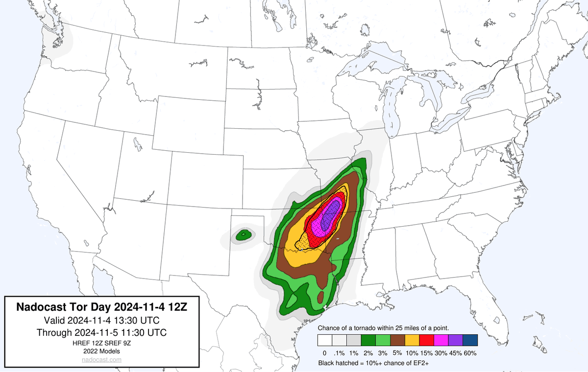
Dangerous day setting up across. Ok/Ark/Tx/Mo. I’m not liking the way things are trending with many discrete cells popping off with a very volatile environmental in place. If storms can stay discrete I wouldn’t rule out a Mod risk in place. Follow me for updates🚨🌪️ #tornado #wx


Confirmed tornado on the ground heading towards tupelo Oklahoma. Seek shelter now!🚨🌪️#wxtiwtter #tornado #okwx


Don’t let your guards down just yet as the tornado threat has lacked so far. You can see the warm front hasn’t made it up much from the red river yet. I do expect it to start to rise further north here soon. The night is young👀🌪️🚨 #wxtwitter #tornado #okwx

PTC 18 expected to become a tropical storm near Jamaica tomorrow and strengthen into a hurricane. Florida Keys stay alert tropical storm watches possible tonight. Gulf Coast should monitor closely weakening expected on approach. 🌀👀#hurricane #wx

Extensive damage here off of Sooner Rd and 89th St. #okwx @NWSNorman @MyRadarWX @SevereStudios

United States Trends
- 1. Dayton 5.807 posts
- 2. Chargers 57,4 B posts
- 3. Seth Trimble N/A
- 4. Kerr 8.372 posts
- 5. Ravens 69,3 B posts
- 6. Quentin Johnston 6.220 posts
- 7. Canada 417 B posts
- 8. Irene 169 B posts
- 9. Drake Powell N/A
- 10. #WWERaw 72,3 B posts
- 11. #GMMTV2025 167 B posts
- 12. Herbert 20,1 B posts
- 13. Lamar 185 B posts
- 14. #Dragula N/A
- 15. Cadeau 9.340 posts
- 16. Maui 16,2 B posts
- 17. Kofi 16,9 B posts
- 18. Heels 22,4 B posts
- 19. RJ Davis N/A
- 20. Corey Alexander N/A
Something went wrong.
Something went wrong.

