AggieAir
@AggieAirUSUUAVs, analytical tools, and processes in pursuit of water-related scientific remote sensing
Similar User

@MacTheKnyphe

@USUWaterLab

@EngineeringUSU

@USU_WATS

@ForestSAT

@IFM_TUM

@kimcalders

@SARevangelist

@Eurisy1

@ClimateLLC_ag

@utahstate_ag

@AmericanGeo

@utahstateITLS

@SciUnwrappedUSU

@UStateScience
Welcome to USU's AggieAir lab. We develop UAVs, analytical tools and processes for water-related scientific research aggieair.usu.edu
Cutting-edge research requires cutting-edge technology. Check it out🤩


Drone delivery is becoming an active part of transportation systems, but they can only go so far before running out of power. What happens when you need vaccines or snake anti-venom from a far distance? Enter @ncstateece, @NavajoTech, and @AggieAirUSU youtube.com/watch?v=apwItQ…
Reseachers use drone to track ozone pollution in the state. @mikeandersonKSL has the story. ksltv.com/668413/reseach…
If you see our new LiDAR showing off in the sky this field season, feel free to wave😉 Better yet, join in and take your research to new heights (get it?)


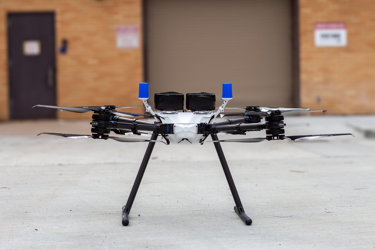
New drone alert! AggieAir pilots Austin Washke and Bryce Lyon spent two days at Watts Innovations in Baltimore receiving hands-on training with our new #drone PRISM Lite VTOL UAS. They're excited to apply their knowledge to our research efforts in the upcoming field season!

Congrats to Karem for winning the Bill Rose Foundation travel scholarship! This scholarship will allow her to present her research on turfgrass quality at Pure Seed Field Day in NC! Photo is of Karem's first place award for presenting this research at a different conference

Remember those high spring flows? AggieAir flew the Logan River to map them, and the story is covered in this newsletter!
Our semi-annual newsletter is out! In this issue, we highlight pollutants in our air and water, and how what our researchers are identifying informs pollution reduction plans. Check it out👇 uwrl.usu.edu/research/newsl… #cyanotoxins #ammonia #cachevalley #pollution
AggieAir has just been granted a Certificate of Authorization for the WHOLE State of Utah, at or below 1,199 feet AGL, class G Airspace. We continue to push the boundaries of UAS operations within Utah and beyond. Huge thank you to Aaron Whittle! Ian.gowing@usu.edu for more info

@USUAggies is recruiting graduate students at the @ASA_CSSA_SSSA conference! Stop by our booth at the exhibitor center, talk with us or take a flyer. I’m also at the conference, you want to talk.

The Team is at @ASA_CSSA_SSSA! Our @KaremMezaC @MrDuran93 and @DrAlfonsoTorres will be presenting our work on grapes, almonds, cherries, urban ET and real-time products using @AggieAirUSU UAV technology and knowhow. If you are at the meeting, come talk to us!

Happy to collaborate with KSL to tell the story of the Logan River and the spring flooding! We hope to help improve flood management and current flood models through our mapping efforts. #remotesensing #loganriver #flooding
Peak flow of the Logan River - and a drone - provided peak information about the floodplain that's helping cities #ut @mikeandersonKSL ksltv.com/?p=572909
Ian Gowing from our AggieAir team flew the Logan river to assess #flooding during those peak flows this spring. Models from the data will help with future events. Read the story here! hjnews.com/news/local/usu… #remotesensing
A great two week field work in progress sponsored by @almondboard that involves @AggieAirUSU @ucdavis @USDA_ARS and many more in California almond fields across Central Valley. Our work is related to large scale orchard mapping and atmospheric profiling to address advection in ET


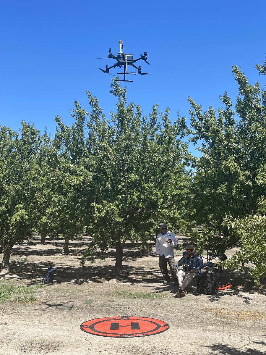

Flying @AeroSystemsWest to measure air temperature across vertical profile for the advection study. It’s also good to see @AggieAirUSU flying the fixed wing for the orchard mapping. @m__roby @nebambach @DrAlfonsoTorres


AggieAir service center at Vacaville, CA 📍 We're collecting air temperature measurements in vertical profile to assess advection effects over irrigated agriculture! #remotesensing #irrigatedagriculture


The AggieAir Service Center has moved south onto Madera, CA, to begin GreatBlue fixed wing flights over 450 acres of Almond orchard to assess water use.


The AggieAir Service Center is in Woodland, CA, flying for the California Almond Board to capture imagery over almond orchards to assess water consumption.💧


United States Trends
- 1. #2024MAMA 830 B posts
- 2. Browns 107 B posts
- 3. Donny Dough N/A
- 4. #FridayVibes 3.790 posts
- 5. Pam Bondi 275 B posts
- 6. Lakers 56,6 B posts
- 7. Steelers 120 B posts
- 8. yeonjun 122 B posts
- 9. Candy Corner N/A
- 10. #FridayMotivation 6.853 posts
- 11. yujin 36,9 B posts
- 12. #ENHYPEN 922 B posts
- 13. #NoMikeRogers 3.477 posts
- 14. Bruno Mars 160 B posts
- 15. Chris Brown 24,1 B posts
- 16. hanbin 39 B posts
- 17. Franz 21,2 B posts
- 18. Mnet 337 B posts
- 19. CONGRATULATIONS JUNGKOOK 21,2 B posts
- 20. Bron 15,8 B posts
Who to follow
-
 Mac McKee
@MacTheKnyphe -
 Utah Water Research Laboratory
@USUWaterLab -
 USU Engineering
@EngineeringUSU -
 USU Watershed Sciences
@USU_WATS -
 ForestSAT
@ForestSAT -
 ForestManagement@TU_Muenchen
@IFM_TUM -
 Kim Calders
@kimcalders -
 Franz J Meyer
@SARevangelist -
 🛰 Eurisy
@Eurisy1 -
 Climate LLC
@ClimateLLC_ag -
 Utah State College of Ag & Applied Sciences
@utahstate_ag -
 The American Geographical Society
@AmericanGeo -
 USU ITLS
@utahstateITLS -
 Science Unwrapped at USU
@SciUnwrappedUSU -
 Utah State Science
@UStateScience
Something went wrong.
Something went wrong.

