Evan Oxendine
@evan_oxendineStorm chasing is my passion/ Weather Fanatic 🌪️
Similar User

@jameshannumWx

@devin_weather

@jack_7909

@juststormchasin

@anemicroyaltywx

@JonathanJZ_Wx

@WXChaserCody

@TikovonlaberWX

@NorthILWX

@ShearConvection

@AdamFWX

@Jadon_wx

@Hayden2002WX

@ZaneFergusonWX

@Cryptic69420lol
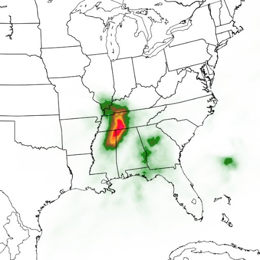
If you want to become Better at forecasting make your own predictions instead of using Nadocast or being a SPC chaser those tools are great to have but knowing what’s going on in the atmosphere down to the surface is better than just posting a model snd being confused and lost.
Watch as I blow by a two field research teams and drive another half mile to intercept this rolling out tornado west of Dodge City, KS
Miss seeing Joel behind the wheel And Reed and Joel disagreeing over target storms
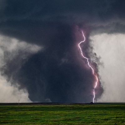
Check out this #tornado intercepted by Joel and I with @KenergyCole in the backseat shooting his show Tornado Fury on May 4, 2007. This was the same day as the Greensburg EF5, but the southern storm. This video was published in Dr Fiedler’s research paper on tornado suction…
Tsunami threat has passed for California

If you were patient this morning you may have observed the rare lake effect snow band waterspout. @ICWR Observed this one just offshore of Hamburg beach around 1020am #NYwx


Winter storm warnings and watches from the NC/TN mountains throughout NY

Looks like a snow globe out here by Carbondale, Pennsylvania snow #pawx
Here is one of my early as-lives in front of a #tornado just north of Wray, CO no mic
Tornado watch issued from Western North Texas through portions of central Oklahoma including the OKC area!

#SPC has upgraded the risk tonight through monday morning to Enhanced for the potential for fast moving tornadoes. Have a way to receive warnings if you’re in the bullseye. Likely an active night starting after midnight CST. Slight risk for tornadoes can’t be ruled out either!

Beautiful sunset earlier in southeastern, North Carolina

I would knock out both @ryanhallyall and @MaxVelocityWX in a boxing match since these streamers don’t work out
Don’t look at the EURO either
Models (GFS/EURO) hinting at a big cold front pushing through around sometime next weekend. This would likely be the front that would interact with the developing tropical storm that will likely impact Florida/Cuba! #STAYTUNED 🌬️ 🌊🌀


It's hard to believe this has been 22 years ago. This was the first time I've seen a wedge and significant damage as an F4 hit Van Wert, Ohio. Though I was already fascinated by the weather, this day forever changed my life, fueling the urge to chase.

13 years ago today, this INSANE storm chase happened in southwest Oklahoma near Tipton with the Dominator 2 trying to intercept an EF4 #tornado
Up to TWO FEET of snow from my friend Jill who lives on top of Lookout Mountain above Golden, Colorado!!

Here is a contrast enhanced look at the parent #tornado north if Idabel, OK as quite possibly the most active November ever in the state of Oklahoma for tornadoes - youtu.be/uu5YuL30rZo?si…

I’m wondering if a PDS watch will be issued for today
10% Sig Tor out for tomorrow across Eastern KS into northwest MO for the possibility of strong tornadoes especially if any prefrontal cells develop ahead of main line!

United States Trends
- 1. $ASTROS 2.884 posts
- 2. $STAGE 4.836 posts
- 3. taina 2.992 posts
- 4. #SnoopDoggXboxChainGiveaway N/A
- 5. Luka 44 B posts
- 6. Greece 47,7 B posts
- 7. Mitch 65,6 B posts
- 8. WNBA 34,4 B posts
- 9. Jamie Foxx 23,3 B posts
- 10. Mel Gibson 20,9 B posts
- 11. Mavs 20,5 B posts
- 12. The Onion 9.833 posts
- 13. Infowars 20,1 B posts
- 14. Randy Moss 4.313 posts
- 15. SantaMoney 3.074 posts
- 16. Jake Burger 2.219 posts
- 17. Shai 16,2 B posts
- 18. Kyrie 12,8 B posts
- 19. #SkeletonCrew 7.471 posts
- 20. Brett 39,9 B posts
Who to follow
-
 James
James
@jameshannumWx -
 Devin_wx
@devin_weather -
 Jack
Jack
@jack_7909 -
 Storm Chaser Alina Cooper
@juststormchasin -
 layne wx 🦋🌩️🌻🎄
@anemicroyaltywx -
 Jonathan Juarez
@JonathanJZ_Wx -
 Cody Reynolds
@WXChaserCody -
 Tiko von Laber
@TikovonlaberWX -
 Ben Davison
@NorthILWX -
 Shear Convection
@ShearConvection -
 Adam F
@AdamFWX -
 Jadonwx
@Jadon_wx -
 Hayden Lester
@Hayden2002WX -
 Zane Hail, Y’all
@ZaneFergusonWX -
 CrypticWX
@Cryptic69420lol
Something went wrong.
Something went wrong.


