Similar User

@kjamradio

@DakotaState

@SDSearchlight

@CEO_Olson

@HeartlandPower

@stwalter20

@MikeWaldner

@570WNAXNEWS

@DJMattG

@CoachRicke

@CrabtreeCasey

@RDockendorf

@KevinWoster
Friday is the deadline for nominating petitions to be filed for this year’s Madison City Commission and Madison Central School Board election. amazingmadison.com/local-news/fri…
All sections of I-90 and I-29 are reopened to traffic throughout the state of South Dakota. I-90, between Mitchell & Sioux Falls, was reopened at 4:30 p.m. Motorists are advised of continued drifting in the eastbound lanes especially near bridge ends. #SDDOT #SD511
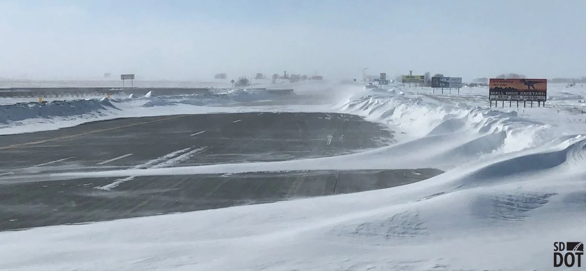
I-29 from Watertown to the North Dakota state line was reopened at 3:30 p.m. • Travelers should expect to encounter ice-covered roads and snow covered shoulders. • Please use extra caution and reduce travel speed. Pictured is I-29 near Peever at 3:15 p.m. #SDDOT #SD511
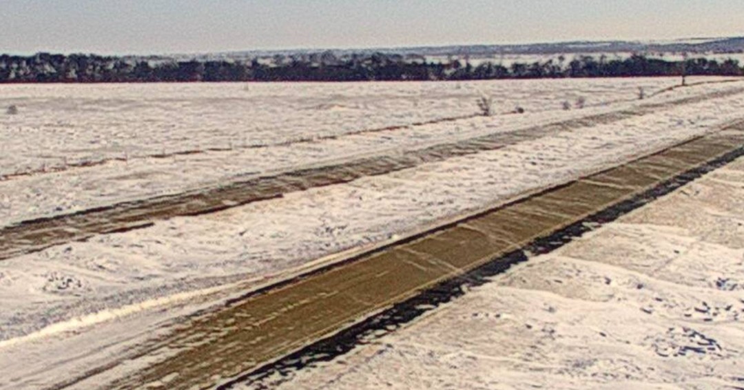
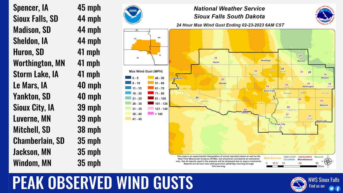
Gathering of data is winding down, and here's a look at snowfall totals & peak wind gusts which have been reported for this week's blizzard. Snowfall trophy goes to Taunton, Minnesota at 21", though the broad swath of a foot plus near/north of I-90 deserves honorable mention!

Sections of Interstate 90 and Interstate 29 are being reopened today, Thursday, Feb. 23, 2023, as conditions improve. For full details on reopenings, please visit: dot.sd.gov/blog/2848/inte… Latest on road and weather conditions, please visit sd511.org or dial 511.


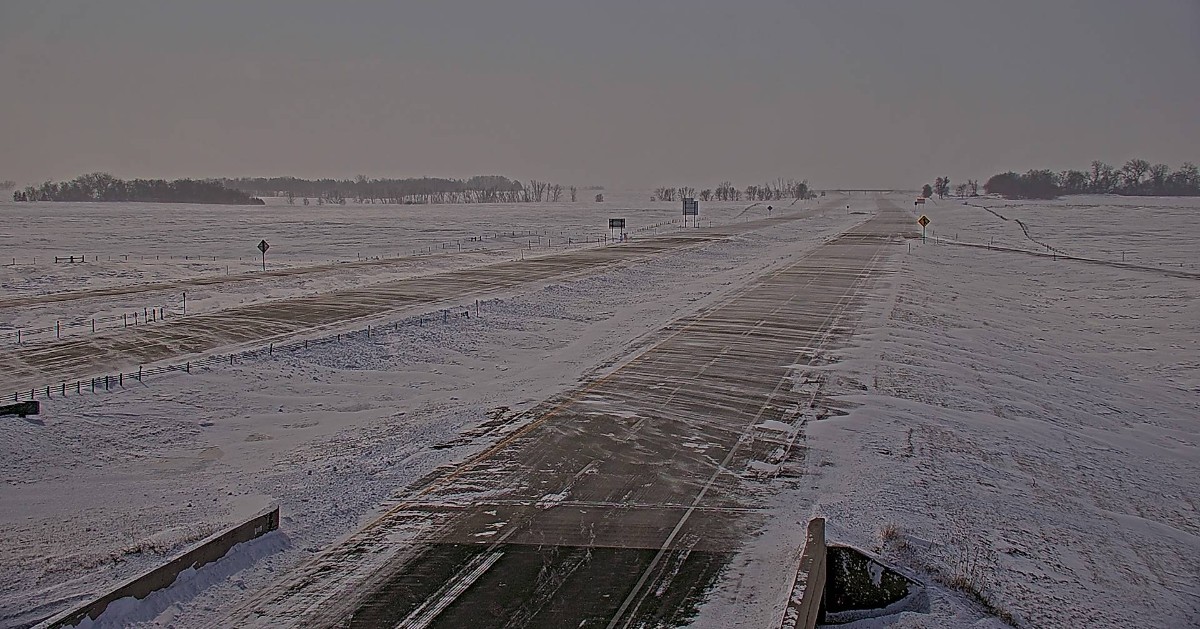
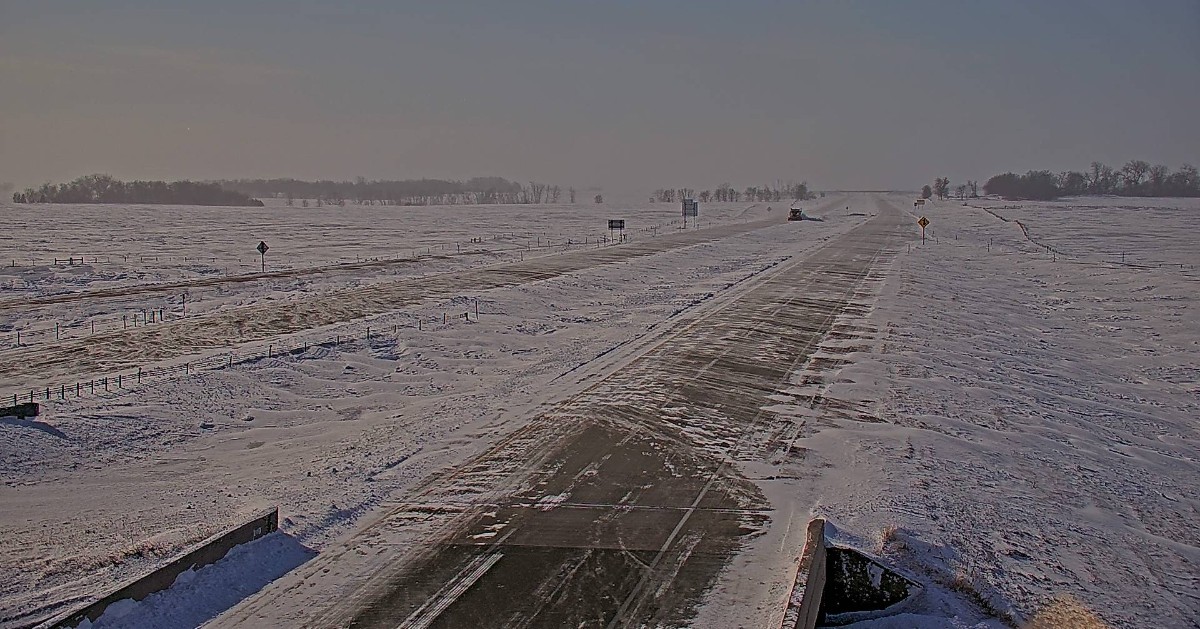
Portions of the SD Interstates are beginning to open, but as you can see in the photo, there is still plenty of drifting. Use caution and drive to conditions if you venture out. Remember, it is still quite cold, with wind chills in the teens and 20s below zero.
I-29 (northbound and southbound) from Sioux Falls to Brookings has been reopened. SDDOT anticipates reopening additional Interstate sections throughout the day today, Thursday, Feb. 23, 2023, as conditions safely allow. Visit sd511.org or dial 511. #SDDOT #SD511
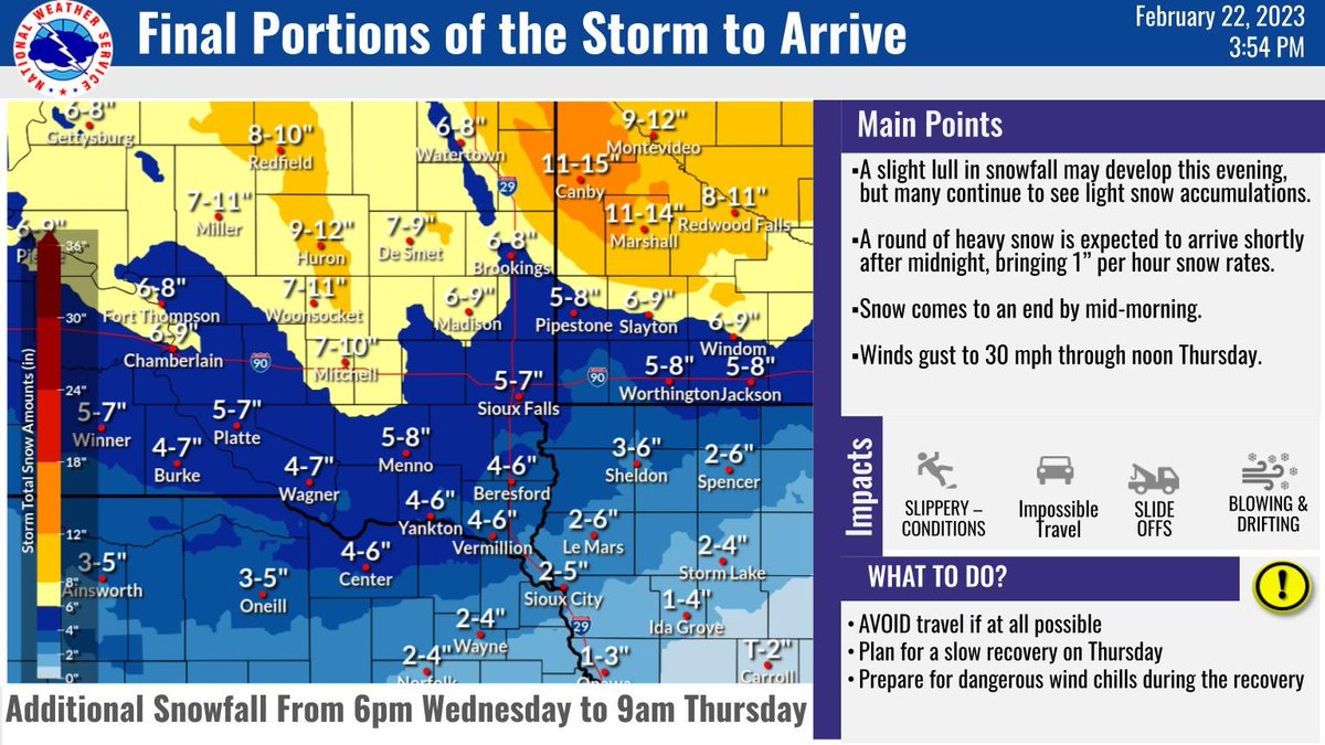
How much more snow could fall this evening and through the night? Here's a closer look. Winds will begin to change directions tonight to the northwest, so expect the direction of drifting on the roads to shift. Avoid travel. Expect high drifting to continue.
Don't be fooled in thinking this event is over if the snow diminishes a bit early this evening. MORE snow is likely after midnight, and it will be intense. Here is a projection showing the hourly snowfall rates up to 1" per hour moving through tonight.
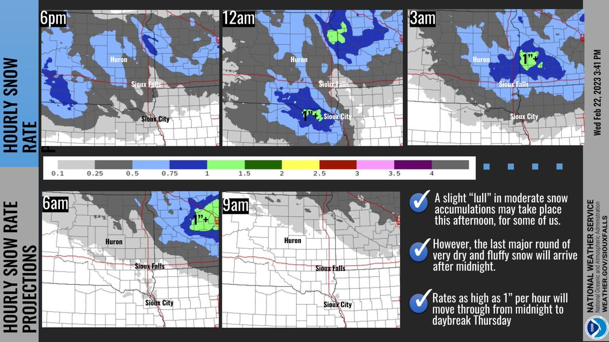
5:30 AM Winter Storm Update 🔹Snow continues today with occasional lulls. Snow may be moderate at times this afternoon and again overnight. 🔹Winds gust 35-45 mph with blizzard conditions, especially in rural and exposed areas 🔹Travel will be difficult, if not impossible


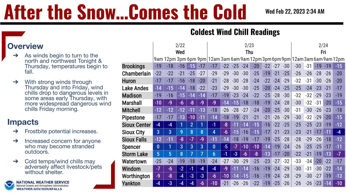
This is the scene all across eastern South Dakota this morning with more snow and stronger winds expected. Segments I-29 and I-90 are closed for good reason. The secondary State Hwys will not be any better. Travel is NOT advised. Be Safe!
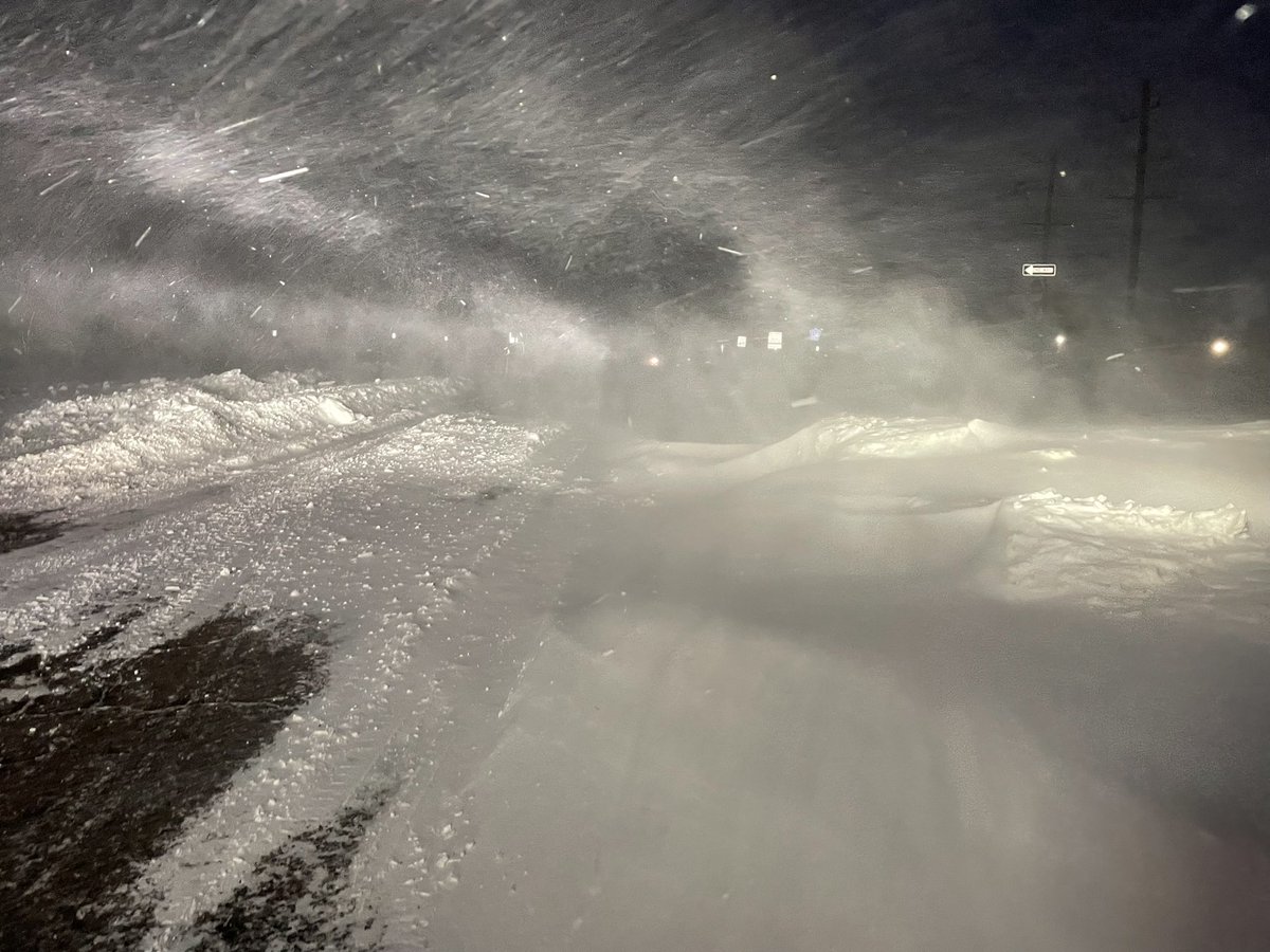
Blizzard warning issued by the NWS for Wed., Feb. 22, 2023, with heavy accumulating snow & high winds causing blizzard-like conditions. Current Closures: • I-29 from ND state line to Sioux Falls (exit 84) • I-90 from Sioux Falls (exit 395) to Mitchell (exit 332) #SDDOT #SD511
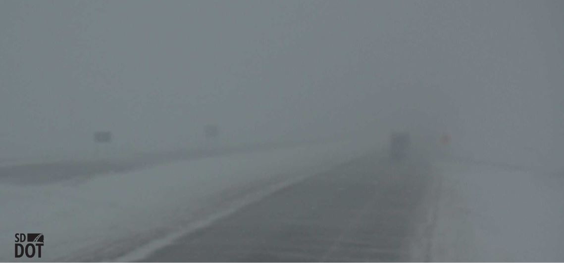
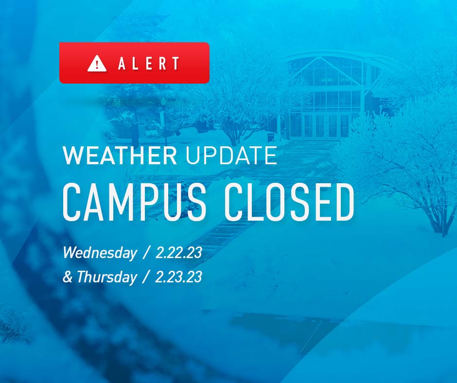
Due to extreme weather, Dakota State University will close its campus and shift classes to remote learning for Wednesday, February 22 and Thursday, February 23.
The following Interstate closures are planned for Tuesday, Feb. 21, 2023: • I-29 from the North Dakota state line to Brookings at 8 p.m. • I-29 from Brookings (exit 132) to Sioux Falls (exit 84) at 10 p.m. • I-90 from Sioux Falls (exit 395) to Mitchell (exit 332) at 10 p.m.
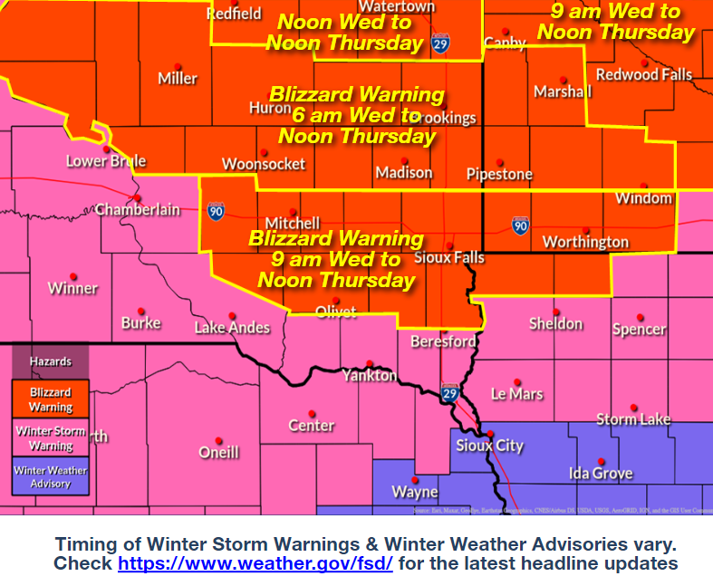
A slight increase in overnight snow along and north of Interstate 90 has led to blizzard warnings beginning earlier on Wednesday than previously scheduled. Strong winds and the light nature of the snow will lead to considerable blowing and drifting of any snow that falls.
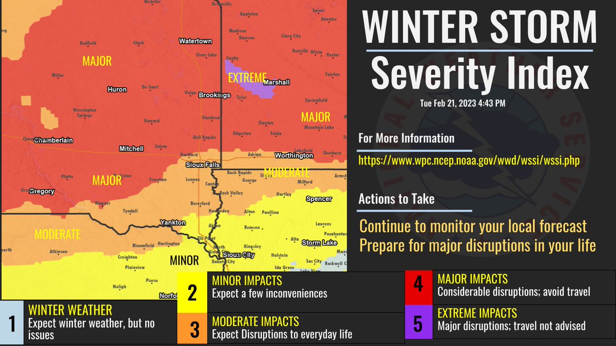
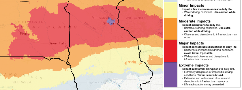
The winter storm severity index, which helps gauge potential impacts from winter weather, continues to indicate widespread major to even extreme impacts from this continuing storm into Thursday. The combination of high snow amounts and strong wind will lead to dangerous travel.
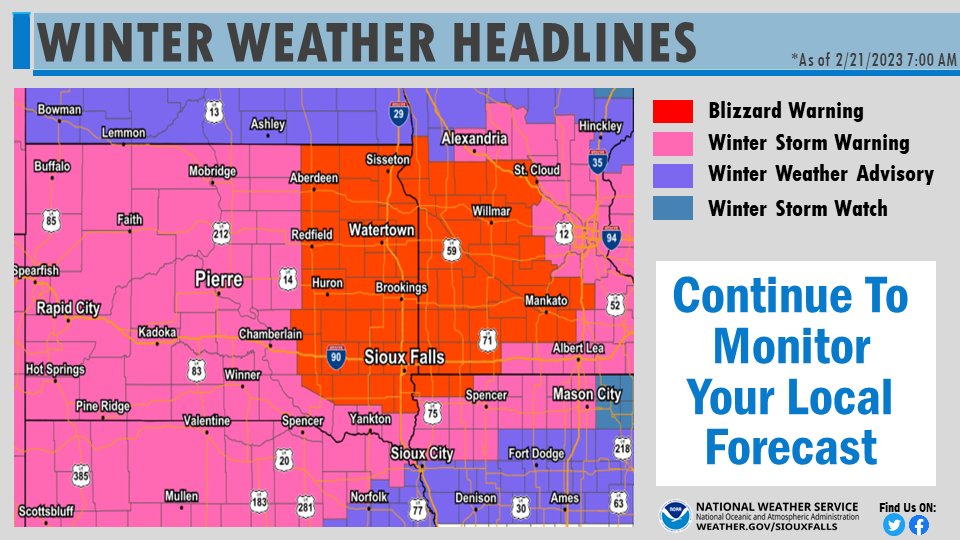
Various winter weather headlines are in effect today through Thursday across the region. The Blizzard Warning runs Noon Wednesday - Noon Thursday. Other warnings & advisories have varying timing, so please check your local forecast for details! weather.gov
It's not often we see the winter storm severity index in the "extreme" category. Well, based on the current forecast data, we've reached that potential for this upcoming winter storm. For more information on the WSSI, please visit this page: wpc.ncep.noaa.gov/wwd/wssi/wssi.…

Impacts from the winter storm midweek are expected to be WIDESPREAD and SIGNIFICANT! 🚙Dangerous to impossible travel. 🔦Disruptions to power. ❄️Heavy snowfall 🌬️Blowing snow/potential blizzard-near blizzard 🥶Frigid wind chills -20F to -30F by Thursday/Friday.
United States Trends
- 1. Friday the 13th 52,2 B posts
- 2. #theblueground N/A
- 3. #Fartcoin 11,7 B posts
- 4. Good Friday 53,5 B posts
- 5. $LINGO 68 B posts
- 6. #FridayVibes 6.043 posts
- 7. Ciri 96,4 B posts
- 8. #FridayMotivation 4.790 posts
- 9. Odell 1.680 posts
- 10. Wordle 1,273 X N/A
- 11. #HappyBirthdayTaylor 10,4 B posts
- 12. Happy FriYAY 1.553 posts
- 13. Witcher 117 B posts
- 14. Recycling 18,4 B posts
- 15. Geralt 13 B posts
- 16. Astro Bot 119 B posts
- 17. Finally Friday 1.925 posts
- 18. One for the Swifties N/A
- 19. GOTY 85 B posts
- 20. Naughty Dog 70,1 B posts
Who to follow
-
 KJAM Radio
@kjamradio -
 Dakota State University
@DakotaState -
 SD Searchlight || bsky @southdakotasearchlight.com
@SDSearchlight -
 Russell Olson
@CEO_Olson -
 Heartland Energy
@HeartlandPower -
 Stacy Anderson
@stwalter20 -
 Mike Waldner
@MikeWaldner -
 570 WNAX + 104.1 The Wolf
@570WNAXNEWS -
 Matt Groce
@DJMattG -
 Michael Ricke
@CoachRicke -
 Casey Crabtree
@CrabtreeCasey -
 Randy Dockendorf
@RDockendorf -
 Kevin Woster
@KevinWoster
Something went wrong.
Something went wrong.


