Nathan Highway
@HighwayWxWeather and Space Enthusiast | Photographer | Assistant of @Overcast_YT | Mildly Uninteresting
Similar User

@weatherguywill

@wx_chloe4

@HannahC_WX

@JoshuaLitseyMN

@JpolmatierW

@Lincoln_Wx

@jobielagrangeWx

@KnaptonOliver

@StormsEdgeWx

@HouckisPokisewx

@Laurenthestorm

@KeenerJayden

@wx_garcia

@xel_artz

@Michael124_Wx
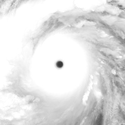
#02S Tropical Cyclone #BHEKI Satellite: #NOAA20 #JPSS1 #VIIRS Channel : I1 (0.64 µm) I5 (11.45 µm) 375-m Time : 2024/11/17 0838Z Eye Temp : 15.656 °C Data Source : Amazon S3 Bucket SDR


Typhoon #ManYi (#PepitoPH) Update: ManYi has made landfall on the coast of central Luzon, Philippines in the province of Aurora with winds up to 130 kts (150 mph) (241 kph) & a pressure of 933 mbars. Signal 5 wind warnings in effect for Aurora, Quirino, & southern Nueva Vizcaya…

#tropicswx #PHLwx | #ManYi (#PepitoPH) has already made landfall near Bagamanoc, in Catanduanes, #Bicol, #Philippines. Landfall was at 140kt (160mph) & a pressure of 921mb. This makes Man-yi the: - Strongest typhoon to hit 🇵🇭 since Rai ‘21 (Odette) - Strongest TY to hit the…
BREAKING: Super Typhoon #ManYi (#PepitoPH) has become an extremely violent CATEGORY 5 Pacific cyclone, sustaining catastrophic winds of 160 MPH (257 kph) and a core pressure of 920 MBAR. Churning towards a potentially crushing landfall over the island of Catanduanes, Man-Yi is…
🚨LANDFALL: Sadly, #Sara was a pick-your-poison type of storm. She was either going to explode into an extremely rare, mid-November Major Hurricane (seriously affecting Cuba, Mexico, and/or South Florida), or punch into Central America as a much weaker, yet potentially…
🚨LANDFALL: The Province of Cagayan in the Philippines has now been hit by TWO Category 4 cyclones in the SAME WEEK. Typhoon #Usagi (#OfelPH) has made landfall in the very remote and mountainous NE region of Luzon, with winds of 130 mph (210 kph) and a pressure of 949 mbar.…
A mere 7 days ago, NE Cagayan on the island of Luzon was hit by a 150 mph (241 kph) Category 4 storm. Now, Typhoon #Usagi (#OfelPH) is approaching this exact same area at almost the exact same strength, and is just a few hours away from a destructive and potentially…
The NHC has initiated advisories on Potential Tropical Cyclone 19 south of Jamaica. This system is expected to consolidate into a tropical storm during the next 24 hours (its name would be #Sara) and track westward toward Central America. Its forward motion is expected to slow…
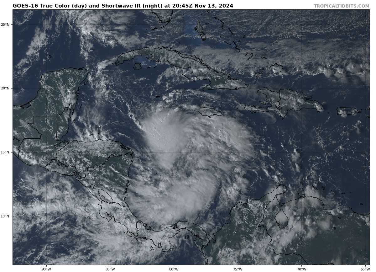
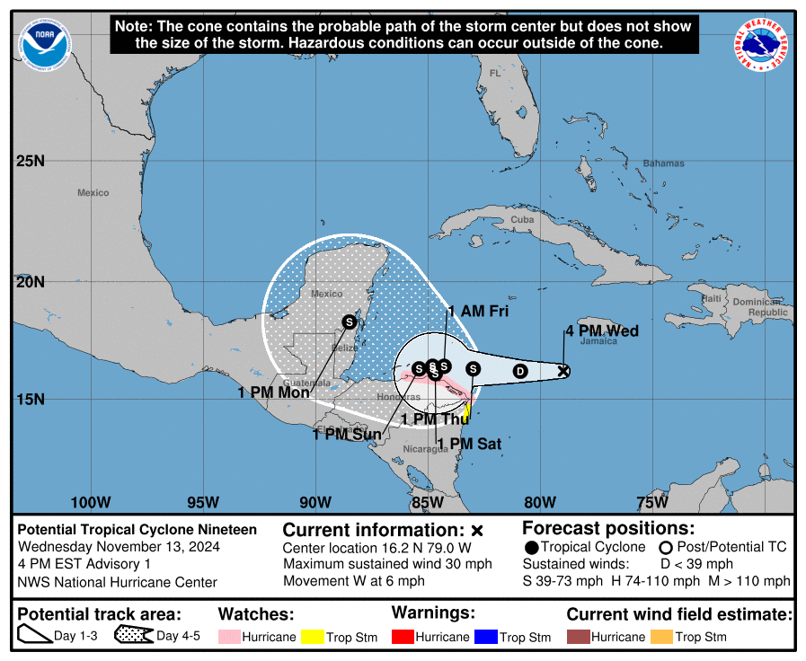
Potential Tropical Cyclone 19 is forecast to become a tropical storm tomorrow by National #Hurricane Center. If it does, it would be 11th Atlantic named storm to form since Sep. 24. That would be the most on record to form between 9/24-11/14. Current record is 10 set in 1950.
JUST IN: TY #Usagi (PH: #OfelPH) is now a Category 4 super typhoon by the Joint Typhoon Warning Center (JTWC) with 1-min sustained winds of 130 kts (~240 km/h) near the center in the US scale - a 55 kts (~100 km/h) increase in only 12 hours! NOTE: PAGASA and the Japan…
#Tropicswx #PHLwx: Typhoon #Usagi (#OfelPH) has rapidly intensified into a major typhoon with 115 mph (213 kph) winds with a pressure of 949 mbars. Also notice how small the eye is since its a pinhole eye, more Intensification is in progress giving how tight the wind gradient is.…
Typhoon #Usagi has developed the dreaded pinhole eye. After appearing just 2h ago, convection has rapidly symmetrized around its ~7nm eye, signaling that #Usagi might be rapidly to explosively intensifying at the moment.
Rapid intensification has started to set in on #Usagi (#OfelPH). This is bad news for Luzon, #Philippines as a pinhole eye has developed & is clearing. We could likely see a major typhoon sooner than later. Signal #4+ warnings are likely to be issued. #tropicswx #PHLwx
Invest #99L is showing signs of improved organization this evening. The convective pattern has shifted from a broad, elongated mess to a more concentrated cluster of thunderstorms with nascent mid-level rotation. While it’s difficult to decipher any low-level reflection at this…
Despite it being mid-November, the upper air environment that invest #99L finds itself in is very favorable, with the nascent disturbance being centered under a vast anticyclone at the point of maximum divergence aloft.


Map of the 2024 hurricane season now including Hurricane RAFAEL. At 159.8 units of ACE, the 2024 season is now considered an "extremely active" or "hyperactive" season. Can we say backloaded season? Reminds me a lot of 1887, 1961, and 2020. Shout out to those calling this a bust…

Seems increasingly likely that a tropical cyclone will be forming in the Western Caribbean later this week, as models uptrend in response to a more convectively active tropical wave. Will be interesting to see how close it gets to Central America.
This tropical wave has remained convectively active as it crosses the Lesser Antilles, with far more thunderstorms than models like the GFS give it credit for. It will be interesting to see what sort of impact this has on models as they correct for it in coming runs.


Hurricane Rafael's evolution over the last week: - Rapid intensification in the Caribbean - Eyewall replacement cycle right before Cuba landfall - Re-intensification to a rare November major hurricane in the Gulf - Rapid collapse due to westerly shear & dry air
The streak of consecutive days with no measurable precip has finally ended! Our entire area received measurable rainfall overnight (~0.1-0.5"). This will NOT have any meaningful impact on the drought, but should briefly quell the extreme fire danger. #PAwx #NJwx #DEwx #MDwx

☔️🥳As of 11 PM Sunday, all of the sites listed below have had measurable rain, so the stretches of days without measurable precip will end at the counts listed below.
As of Sat. here are the streaks of days without measurable precipitation: ABE 16 days ACY 38 days - record longest MPO 26 days - tied for 2nd longest PHL 42 days - record longest RDG 16 days TTN 42 days - record longest ILG 42 days - record longest GED 43 days - record longest
United States Trends
- 1. McDonald 50 B posts
- 2. #AskFFT N/A
- 3. Mike Johnson 53,9 B posts
- 4. Good Sunday 70,1 B posts
- 5. #sundayvibes 8.221 posts
- 6. #RollWithUs N/A
- 7. Go Bills 4.931 posts
- 8. Big Mac 4.801 posts
- 9. #AskZB N/A
- 10. Coke 33,4 B posts
- 11. Sunday Funday 4.970 posts
- 12. Tillman 1.795 posts
- 13. #ATEEZ_1stDAESANG 12,5 B posts
- 14. Happy Founders N/A
- 15. Jon Jones 297 B posts
- 16. NFL Sunday 5.489 posts
- 17. CONGRATULATIONS ATEEZ 22,3 B posts
- 18. Founders Day 1.117 posts
- 19. Blessed Sunday 20,9 B posts
- 20. McDs N/A
Who to follow
-
 Will Ydrach
@weatherguywill -
 ℂ𝕙𝕝𝕠𝕖
ℂ𝕙𝕝𝕠𝕖
@wx_chloe4 -
 Hannah Cavender🌪
@HannahC_WX -
 Josh L
@JoshuaLitseyMN -
 Jonathan Polmatier
@JpolmatierW -
 Lincoln Hauser
@Lincoln_Wx -
 Jobie Lagrange
@jobielagrangeWx -
 Oliver K
@KnaptonOliver -
 Storm’s Edge
@StormsEdgeWx -
 Brandon Houck ⚡️
@HouckisPokisewx -
 Laurenthestormchaser
@Laurenthestorm -
 Jayden Keener
@KeenerJayden -
 Jose Garcia
@wx_garcia -
 XelArtz
@xel_artz -
 Michael WX
@Michael124_Wx
Something went wrong.
Something went wrong.

